@sharick If you’re able, check this out. I think it might coincide with one of your hotspot fires?


@sharick If you’re able, check this out. I think it might coincide with one of your hotspot fires?
Thank you for the heads up; I did not see this.
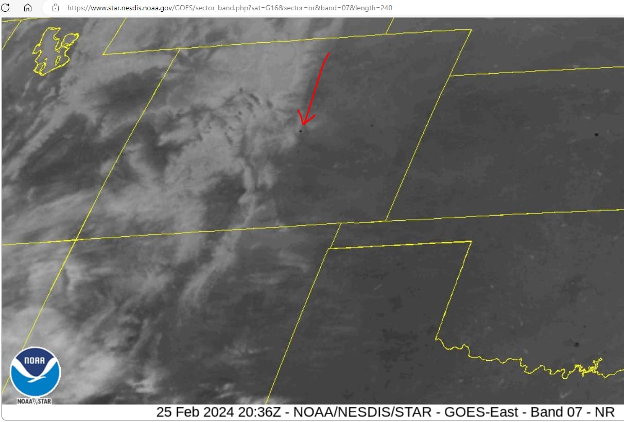
Paste this string into the URL and delete the space ahead of “star”
https://www. star.nesdis.noaa.gov/GOES/sector_band.php?sat=G16§or=nr&band=07&length=240&dim=1
There is indeed a persistent back dot in El Paso County. I see it starting at 20:21 and maybe ending at 00:01; almost four hours. Other hot spots can be seen in OK, NE, and AR.
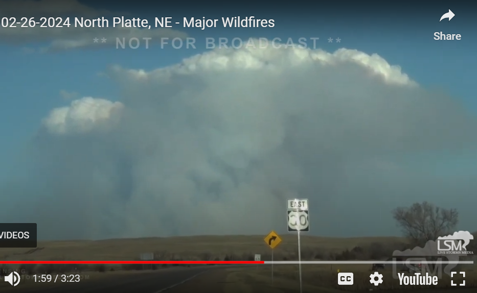
Great video; one of the best I’ve seen at the beginning of a fire.
I don’t watch the west very much as the constant cloud cover masks a lot of the activity.
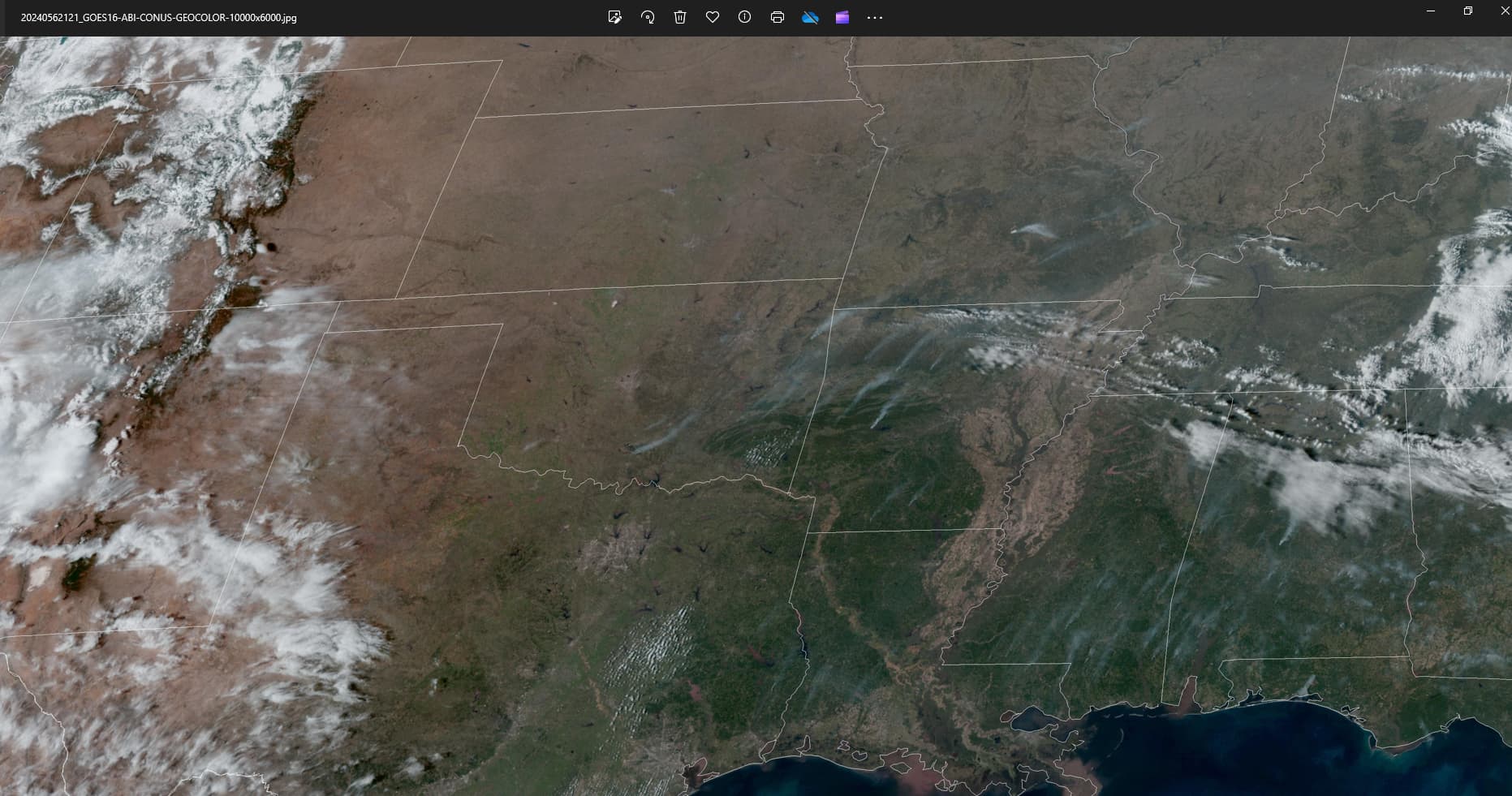
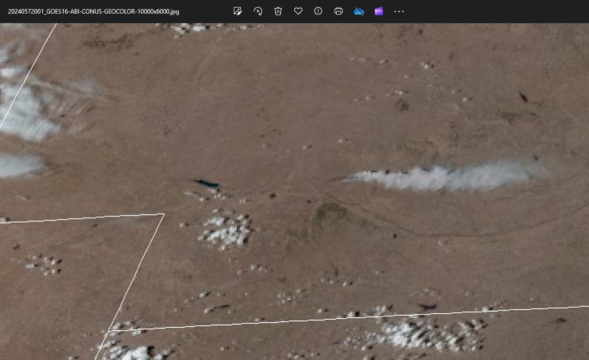
Black dots are from 13:21-17:01 (MST). Plumes will lag in time. I could not discern any plumes in the GeoColor imagery; the one below can be used as a comparison. There were many fires again yesterday. The CO plumes seen in the video are small; tame if you will compared to all of those seen from space. It takes a really big fire to show up like a flag on the satellite visible channels.
There is another post on this site about a balloon over this area 3 days ago. Are the balloon and the fires related???
@beaver Thank you for the compliment; however, you overrate my expertise.
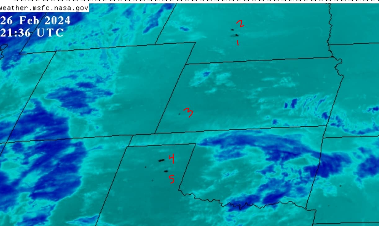
There are a couple of black dots at the southern border of El Paso County, Colorado today; far less than yesterday. The balloon aspect is possible, as I have seen many a “spooky cloud” in the general vicinity of hotspots. Perhaps this one has a broken cloaking device or it is braver than the others. Pure speculation.
Much more disconcerting is Lincoln County, Nebraska. Man, what a concentration of black dots! This is the most intense I have seen to date in terms of burn speed. Wow.
How can PRAIRIE burn that hot that fast… without help? Please everyone, don’t say it is the wind, as that is what MSM talking heads will say, just like in Lahaina. Yeeess, there is wind there obviously, but grass and brush does not burn hot and slow like trees do. This zipped across half the county length in just four hours.
I don’t mean to hijack the thread, but folks need to wake up to these very frequent and very unnatural wildfires. Does ANYONE here watch the animations?
Update 16:48 EST:
Now a fire has broken out in Logan County, Nebraska just north of the other one. Texas panhandle has two big ones as well. Lots of strange little puffy white “candy clouds”, just like Marshall, Colorado in 2022.
@sharick
Comparatively speaking, I don’t think I’m over-rating you with regard to hotspots, whereas, in my case, I have no gift whatsoever.
Nope, even I know it’s not wind. I have the same question now that @JFYates has, re: Balloon location when the fire started. If you look on the other thread in which I copied you, sure looks like it. Hard to believe in that koinky dink.

Particles scatter light, act as starting point for cloud formation and initiate or limit rainfall.
It makes me wonder if the fires are used for the particles they create. Even to be steered to a different continent where they can create havoc. And what’s the purpose behind the chem trails? Are they dimming the sun as per Bill Gates bright idea.
@beaver This is good video; thank you for posting.
How does prairie/brush fire generate so much heat?
If ignited artificially, evidently, they have methods. I have no idea but I think they might be ‘practicing’. The hotspots of late have gotten a lot of rain in the past month or so.
@Sandygirl These fires, if you are referring to recent ones discussed in this thread, are miniscule compared to those of Canada-2023 and South America-2024. If you look at this post, three images show progression of wildfire smoke as it travelled from western Canada and out the Atlantic toward Europe. There were instances where heavy Canadian smoke was looped above the Arctic Circle and then over to the northern Pacific. Canadian smoke was also delivered to Miami, Florida of all places.
They are an airborne weapons platform that delivers a specified aerosol mixture, “cocktail” if you will, at specified altitudes for specified durations in specified regions, all over the world, 24/7/365. They have been doing this full scale since 1998. Understand the aerosols require excitation from external energy sources, and collectively all of this is referred to as geoengineering. The uses for them are legion, but broadly speaking, I believe they are used for:
Some of this is speculation; however, it is speculation based on some really good evidence acquired over 25 years:
I cannot recommend enough Elana’s books and Dane’s movie, “The Dimming” to get up to speed. Elana connects a lot of dots and shows the broader and darker direction this is all going. Dane’s video is a great primer on the spraying/irradiation/secrecy parts of it.
It isn’t his idea; he is just the notsoappealingbillionairemouthpiece for it. The patents and experiments go back more than a century. I believe Gates’ more recent suggestions for spraying sulphur into the atmosphere is cover for the rampant spraying activities that have been normal and present since '98. In essence, his “idea” will formalize and normalize it for the sheepublic.
Thank you for your reply. Some new theories to ponder and check into. I remember watching a video about the earthquake in Turkey (a few years ago) was caused by using the ionosphere, earth and a military ship that was near by. Sorry I can’t explain it, but it seemed plausible.
@Sandygirl Elana Freeland discusses earthquakes in her books. Some speculate the 2011 earthquake and tsunami in Japan was another such example.
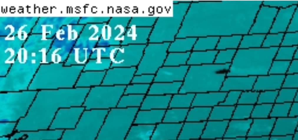
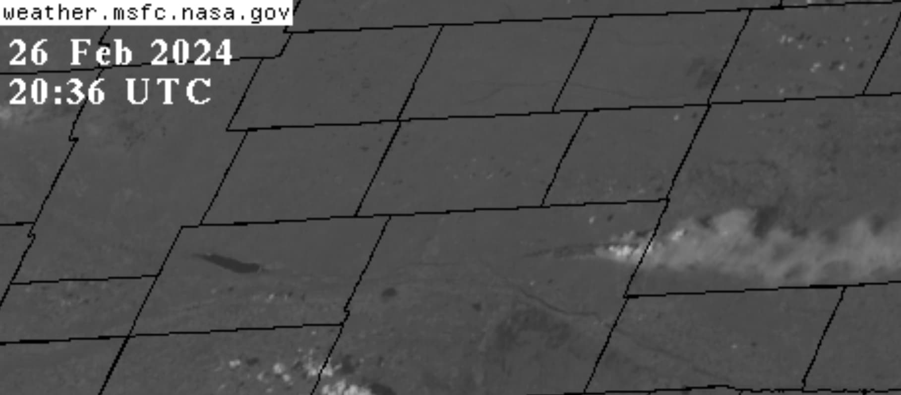
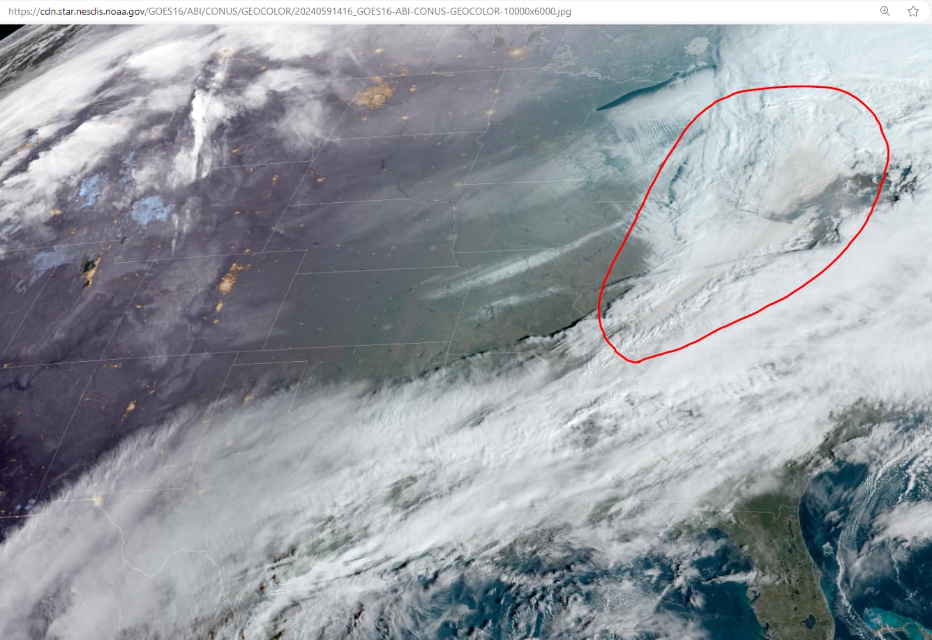
When I replied to your quote two days ago, the panhandle fires weren’t stoked yet and we were evaluating the Colorado fire. If you look at the encircled area in the image below, there is a stream of clouds with brownish cast. The image is timestamped 09:16AM (EST) today (28 Feb 2024). I believe the haze is smoke from the Texas-Oklahoma fires. I cannot tell if any of the smoke made it to the Great Lakes in time for the tornadic weather or not.
I’ve listened to Elana Freeland a few times and I think Joseph did an interview with her a few years back. Her information and knowledge portrays a very dark picture for humanity, it’s frightening to hear her talk about the programmed nanobots. ‘They’ know dark, we know Light, Love, Peace, Joy and Freedom.