
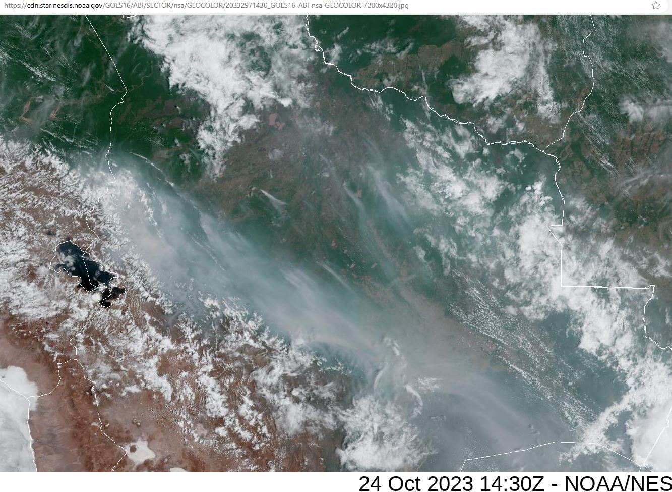
Bolivia
Can add Northern Australia to the list . Information below was posted yesterday by Dr Robbi Bishop-Taylor an earth observation scientist working for Geoscience Australia
3 Likes
Thank you for the suggestion, @sunnyboy. Wow, it looks really bad from what that link showed.
Understand that I do not scrutinize weather and fires much beyond the western hemisphere; mostly because of time constraints but also from a limited understanding of non-NOAA geostationary satellite websites. There is so much happening in North America that I would like to post, but seldom find time to sit down so post something semi-intelligible and informative.
Some of these intensified fires may have started from natural or accidental causes; else they were intentionally set, either by arson or DEWs. I contend that all intensified fires (those with unnaturally-appearing satellite infrared signatures) are perpetuated by DEWs. They are rampant, daily criminal acts in plain sight and the world is clueless.
2 Likes
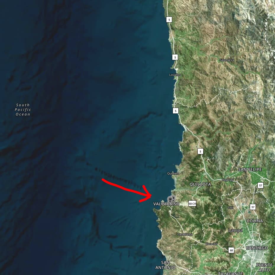
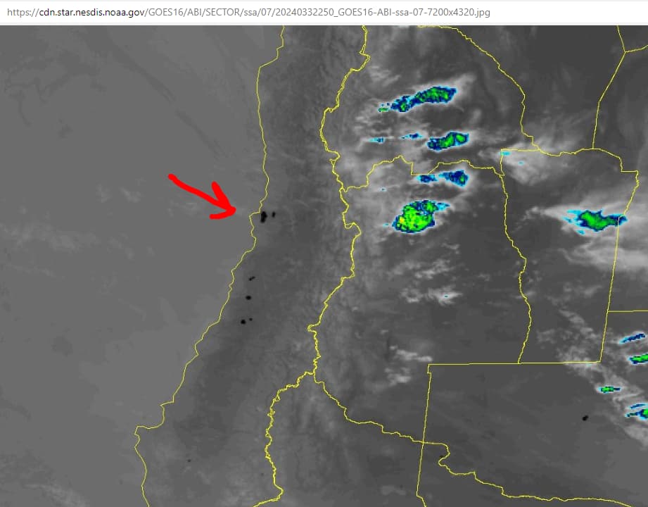
Chile’s turn, it seems. Some images of rubble reveal signs of excessive heat such as that seen in the Lahaina fire and many in California. No surprise, especially upon seeing the infrared surface temp indications.

3 Likes
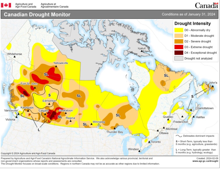
The article linked below provides some additional information on the wildfire impacts.in Chile that might be of interest. In SW BC the mountain snow cover was recently reduced to 28% of normal by a prolonged “Pineapple express” potentially setting the stage for a bad fire season especially if the drought situation does not improve.
. The peach and nectarine crop in the central interior is a write off due to severe bud kill caused by an early deep freeze followed by thaw cycle. T
3 Likes
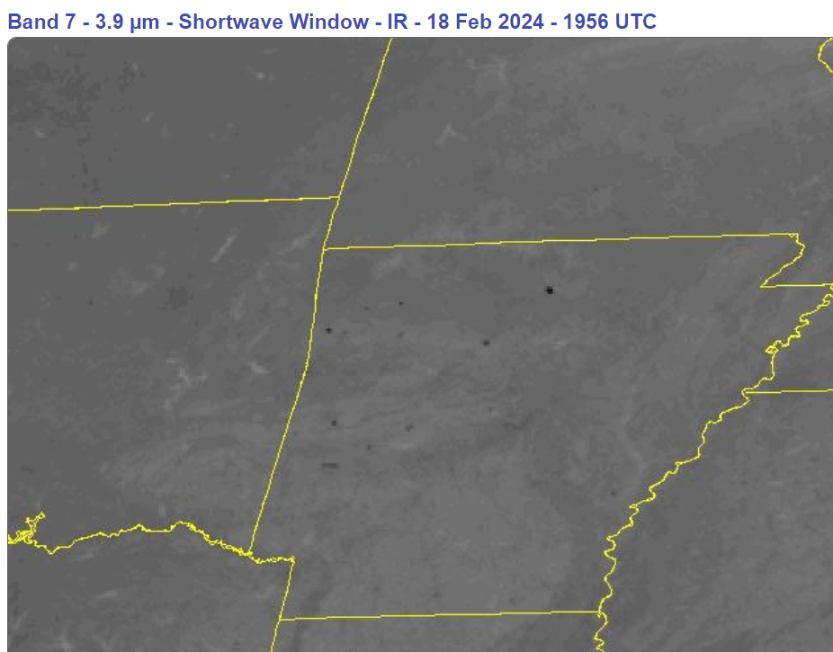
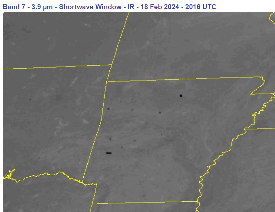
Feb 18, 2024: Arkansas, Louisiana, Mississippi, Oklahoma, Texas
Not a peep on the news, so far as I can tell. These areas are too green; they must be changed to brown.
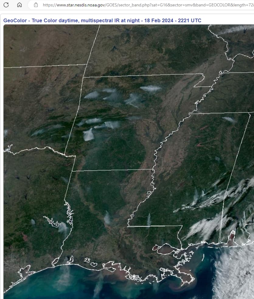
In 40 minutes, the forest in east Arkansas (Polk Co) goes from nothing to maximum infrared surface temp (below). Three synchronized linear dots, how natural.

1 Like
@sunnyboy @sharick
Thank you both very much for tracking all this. VERY important! If you don’t mind, I would like to post a few of the illustrations on my ‘BRI burn’ thread.
1 Like
Why might someone be setting all these fires? Hoisting all those chemtrail particulates up to 40K feet has to be very expensive/inefficient. Perhaps it’s much easier for them to set fires and let the particles (smoke) lift themselves up to modify albedo/the sunscreen.
1 Like
@XSEXCESS I don’t believe cost is an issue for any endeavor of the elites. After all, it is not their money being expended.
As to why, for certain, we will likely never know. The particulates can be useful, but I believe the fires must be of California-2021 and Canadian 2023 size to have sufficient effect as sunscreen. Any observation of the eastern Pacific along South America would reveal that they have no problem creating sunscreen on a daily basis. It is the same pond scum as they parked alongside North America from 2020 through 2023.
I also think the particulates greatly enhance rapid nucleation of water molecules.
These Arkansas fires, like most I’ve seen in the southern U.S. (for several years) are the drive-by-DEW fire types, which die down quickly at sunset. They most frequently occur in forested parks, sometimes in conjunction with controlled burns. Few people, both here on Giza, and in my circle of contacts, are interested in these fires. It is not worth the time to investigate and catalogue anything about them.
I will say again, it isn’t the STARTING of these fires that is of primary importance; rather, it is the INSTENSIFICATION & PERPETUATION of them. Take away the external energy source, the weapon, whatever “it” is, and these fires would be fractional in size, regardless of the wind (that they also create). Artificial clouds, chemtrails, aircraft, spacecraft, satellites are viable candidates as the weapon platform(s). Is the weapon platform beaming invisible directed energy to heat the area? Or is the platform providing some sort of heated discharge path out of or into the earth? To achieve the blinking black dot patterns of intense surface heat shown on satellite infrared channels, requires quite a bit of added heat.
It is only speculation, but I contend that some sort of combined laser-microwave technology exists that is aloft in the atmosphere. Nanoparticle clouds may serve as lenses to direct and focus the energy and/or cover for advanced aircraft. Since most black-dot fires subside at sunset, I further speculate that solar radiation forms part of the energy source, perhaps as a power supply. I estimate that some 80-90% of all black dot fires begin at noon and end at sunset.
Robert Brame makes a good case for microwave technologies as he has forensically examined some 38 fire sites in California.
I also believe drought and soil damage is occurring from the fires, likely intentional, too. I have seen fires that left me wondering whether burning combustibles on the surface are an unavoidable outcome of heating the soil, bedrock, aquifers, etc., below. Heck, I don’t know how deep the energy propagates. And then there is the seismic fault aspect. What a great toy, eh?
3 Likes
Feb 19, 2024: Arkansas, Louisiana, Mississippi, Alabama, Florida, No & So Carolina
I spy with my little eye 14 easily seen plumes. How 'bout you?
1 Like
Thank you for posting this! As you know, I’m paying particular attention to these blazes. I wonder how far to the east they extend. What a lovely barren roadway the flames have created at Donnie Creek! If you don’t mind, I’d like to post your article on the BRI thread. Thanks again.
1 Like
It’s in the public domain…I don’t mind at all. 
1 Like
Bill: “Dang it Hillary I told you to kill the sound on the stereo. You went and Epsteined the Butler!”
As Gomer Pyle used to say, “Surprise, surprise, surprise!”
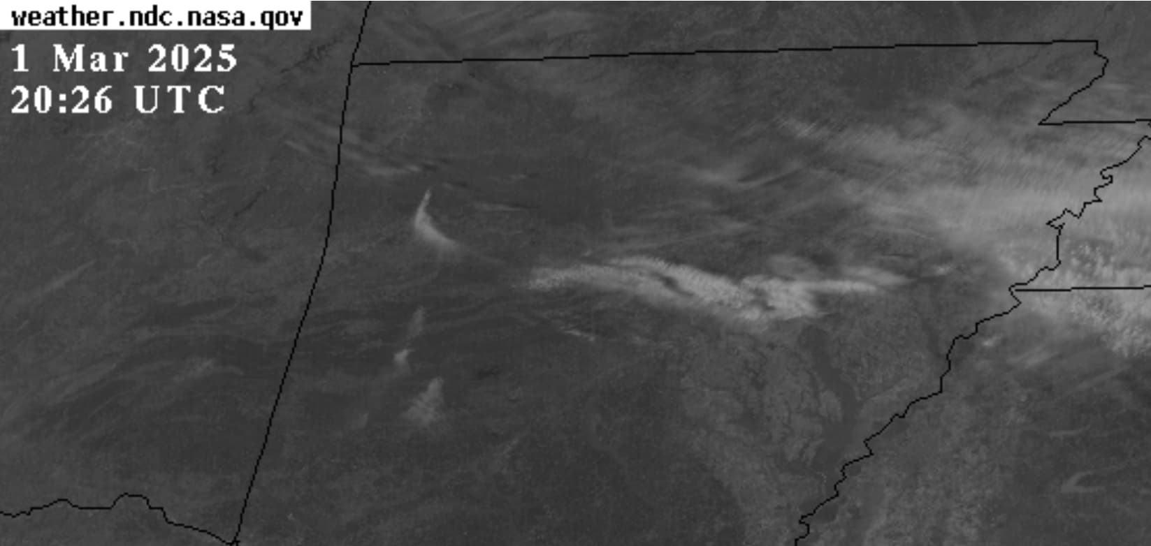
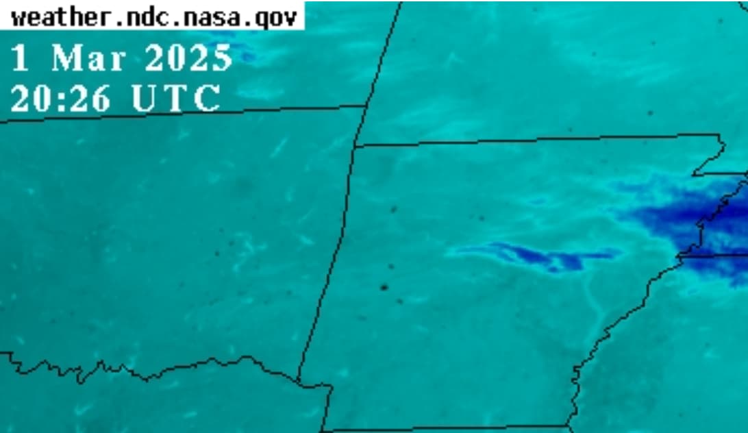
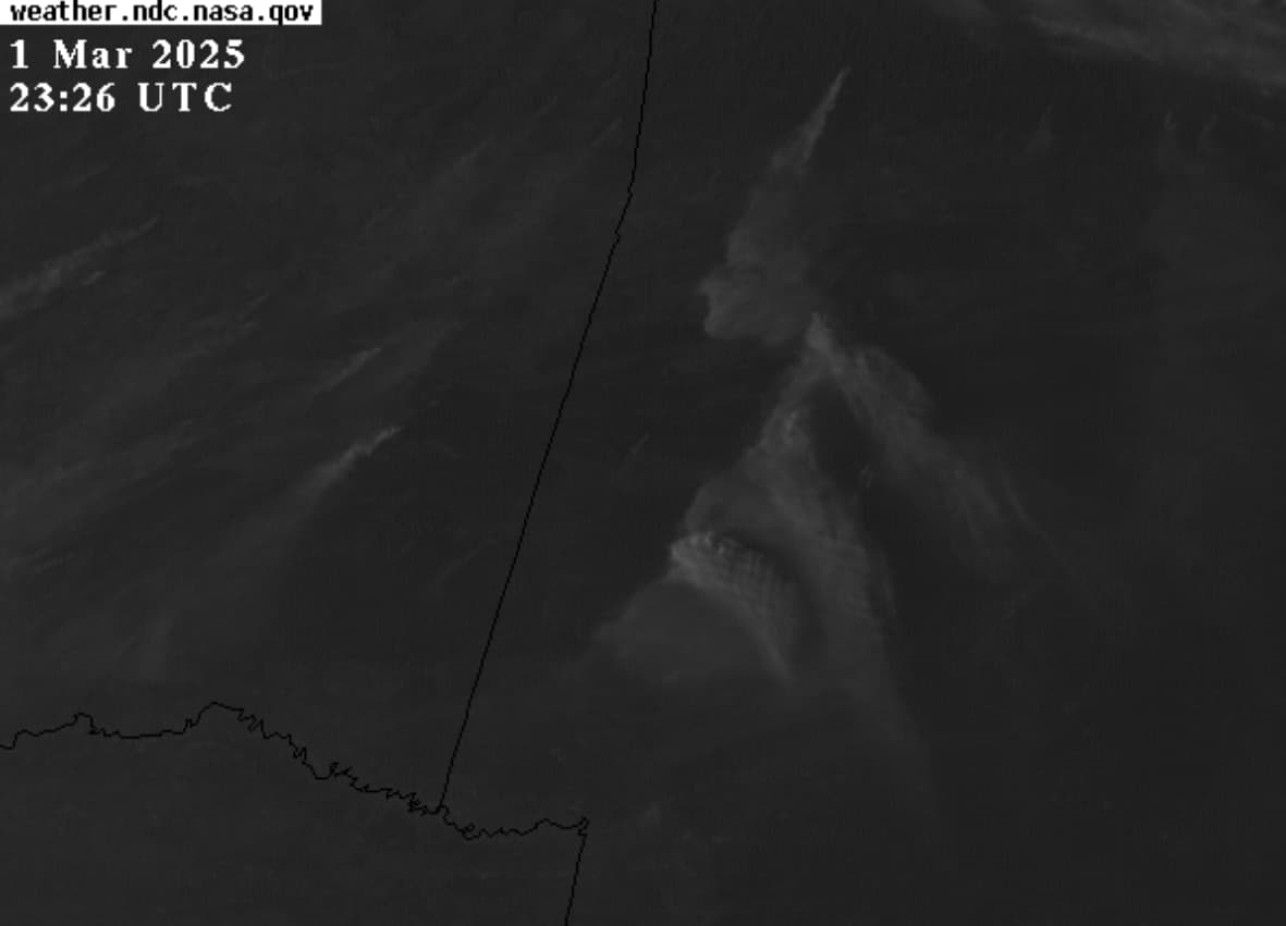
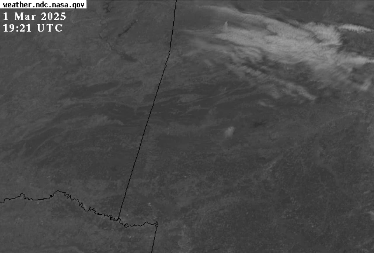
It is February, 2025 and guess what? More flickering hotspots and plumes in central southern U.S.; most notably in Arkansas. Maybe with accumulating evidence (Lahaina, Palisades, Smokehouse Creek, etc.) the phenomena of hotspots flashing on and off in the middle of winter across many states may not seem so normal.
(NOTE: The phenomena doesn’t happen at night; so be sure to tune in tomorrow between lunch and sunset. This will continue for weeks. Also note the cloud behaviors.)
Last 4:20-hrs of infrared imagery (click here)
Last 4:20-hrs of visible imagery (click here)
1 Like
It’s Arkansas after all…probably moonshine stills (humor).
In the space of four hours, we go from no fire to volcanic eruption. Multiple fires in Oklahoma and Arkansas synchronously intensify. Dems big fires, folks.
My supposition:
With the Low Pressure pushing across the US, smoke from these fires might help blanket parts of the northeast with cloud cover, thus giving the impression it’s colder than it really should be with out all that smoke.
Hmm. Last weekend everyone here in central Ohio was noticing a thin brown film on their cars overnight, and when people started asking why, the authorities said “winds in Texas & Oklahoma blowing dust.” I am older, so that answer always smelled rotten to me - there’s been dust from Texas & Oklahoma for the past 70 years and longer, and there have been windstorms for equally as long. How come nobody had ever seen this film in early March before?
2 Likes