
For those who don’t believe man has control of the weather, please watch the NOAA Image Viewer now (it is currently 09:15 AM EST). Watch as “they” build the atmospheric river that “California is tapping into” (Weather Channel phrase). Today’s crap show is an exceptional opportunity to see live behind the curtain. Please take a moment to watch via the NOAA links below.
Band-8 on the Image Viewer shows upper troposphere water vapor and IMO best reveals some of the levers “they” use to modify the climate. Band-14 is like color radar and Band-Geo is a composite of day and night cloud imagery.
I strongly recommend setting the Loop to 240, which provides the most recent 20 (or 40) hours of images, depending on which region is selected. For those with low internet speeds, it will take a long time to load 240.
What do I see?
-
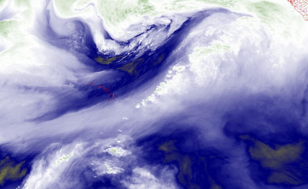
Many energy waves can be seen emanating from Hawaii, some herring bone, most are straight beams that distort the passing air masses.
-
Heating of the chemically-nucleated water vapor can be seen both north and east of Hawaii. All of those leetle bursts are not naturally-occurring clouds folks.
-
The rotating “low pressure system” (haha) off the coast of Washington along with a counter-rotating system south of the Aleutians together are setting the upper boundary of the atmospheric river.
-
There is a lot of water vapor that has been and is being created, especially north of Hawaii. That rotation north of Hawaii is troubling, as it is massive and they are seeding it heavily.
-
Once aloft, water vapor will be directed and carried to its destination thousands of miles away where it will be irradiated (heated) to make the high-altitude clouds that produce deluge.
My Predictions (I hope all of these are wrong, BTW):
- Massive rain and flooding for lower altitudes and more Sierra snow accumulation
(both already stated by Weather Channel) - Refinery damage (cities of Benicia, Martinez, Rodeo and Richmond).
- Levee failures
- Flooding of the Central Valley
At the moment, this storm is slated to bring more snow. What if it warms up? What if it is the first in another series of storms? This one might be to grease the skids for an epic disaster, flooding the entire Central Valley. There is SO MUCH snow up there.
The California Central Valley is the breadbasket of the world. Given the penchant for food destruction, this is the perfect scenario to bring it about.
The Weather Channel (IBM) once again sees into the future like they have a time machine. The headline in the Image-1 video started running yesterday, with the annoying mouthpiece saying, “The west coast is tapping into an atmospheric river…”. I don’t believe they have super-smart weather models; instead, I believe they are informed by the super-smart weather makers.
