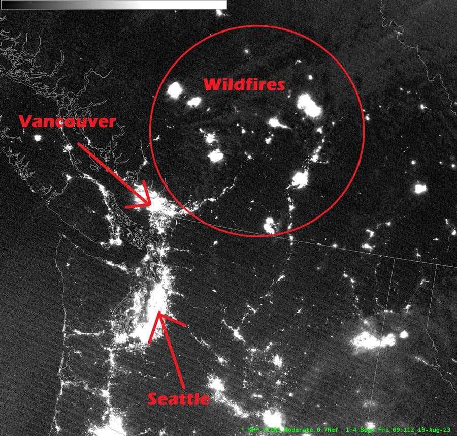
From Seattle NWS —
“Suomi NPP nighttime satellite imagery from last night. Normally, only the population centers would show up distinctly on a clear night. Instead, we also find the bright areas over interior British Columbia from intense, large wildfires”.
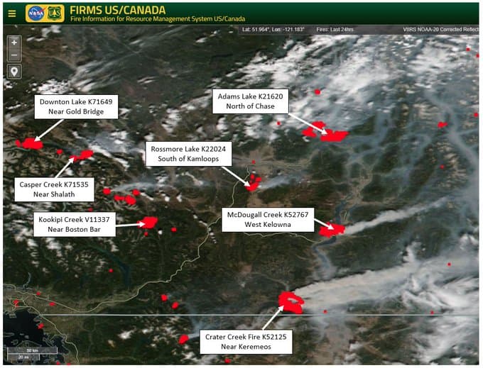
From Matt MacDonald BC Wildfire Service Meteorologist
“Suffice to say that the last 24 hours have delivered Extreme Fire Weather conditions and therefore Extreme Fire Behaviour across southern British Columbia. The heat, convective columns, and smoke coming off these fires is immense.”
Also from Matt MacDonald – Aug 15 night imagery
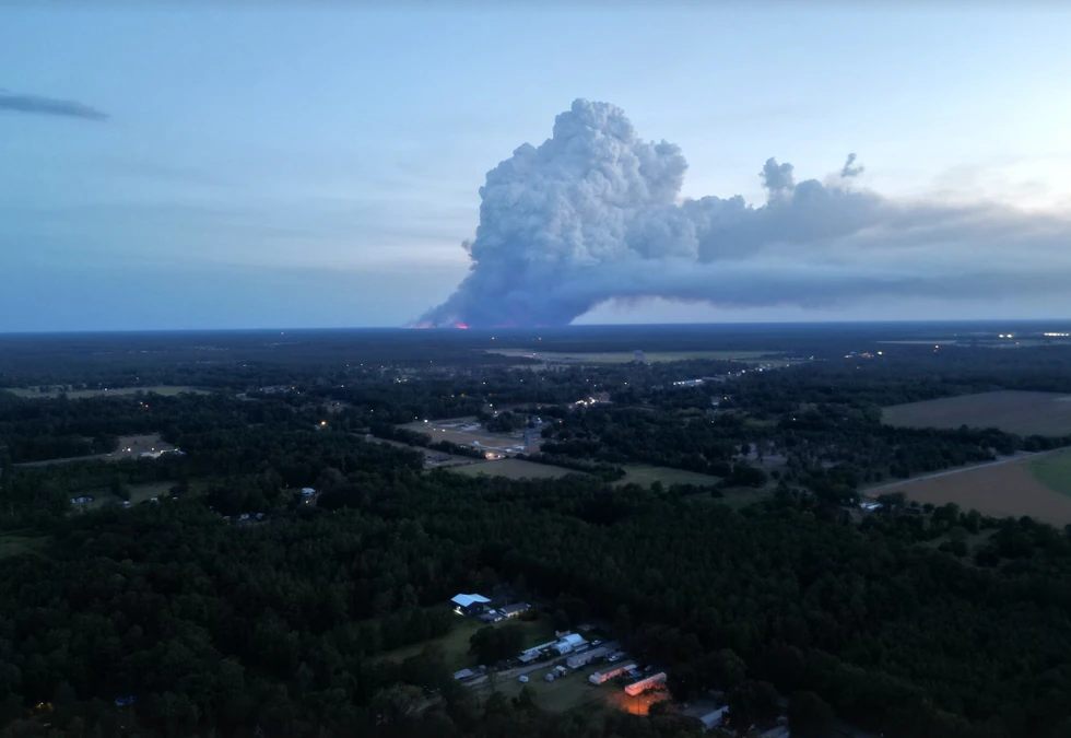
" This is one of the most incredible fire photos I’ve seen to date!! Photo taken during a thermal scan flight over the Adams Lake fire shows a lenticular cloud above a pyrocumulus cloud , simply incredible!!