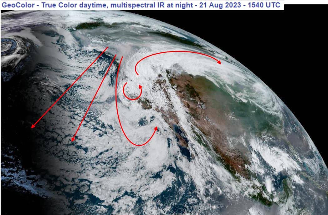
New patterns of air mass rotations, long thin cloud lines (thousands of miles) and abrupt, tightly formed direction changes have permeated satellite imagery the past year, really, and are always increasing in size and development speed. They have honed their craft. I haven’t posted about this because without video and an experienced eye (one who watches daily), most would dismiss it, much like my early posts about DEWs in Kansas, etc.
The weather event so far known as Hurricane Hilary (now a Tropical Storm) is so, so unusual folks. Setup and delivery of this manmade cyclone is unprecedented as a whole, but the bits and pieces used look very familiar.
Band 08 shows upper troposphere moisture level (NOAA West Full Disk Band 08). This is where jet streams used to live; now, it seems to be their air mass control board. Dark blue, yellow and orange are areas that “repel” moisture will push moisture-laden air masses away or said in other words, it sets a boundary. Have you wondered why Hilary’s western edge was so clearly defined and vertical?
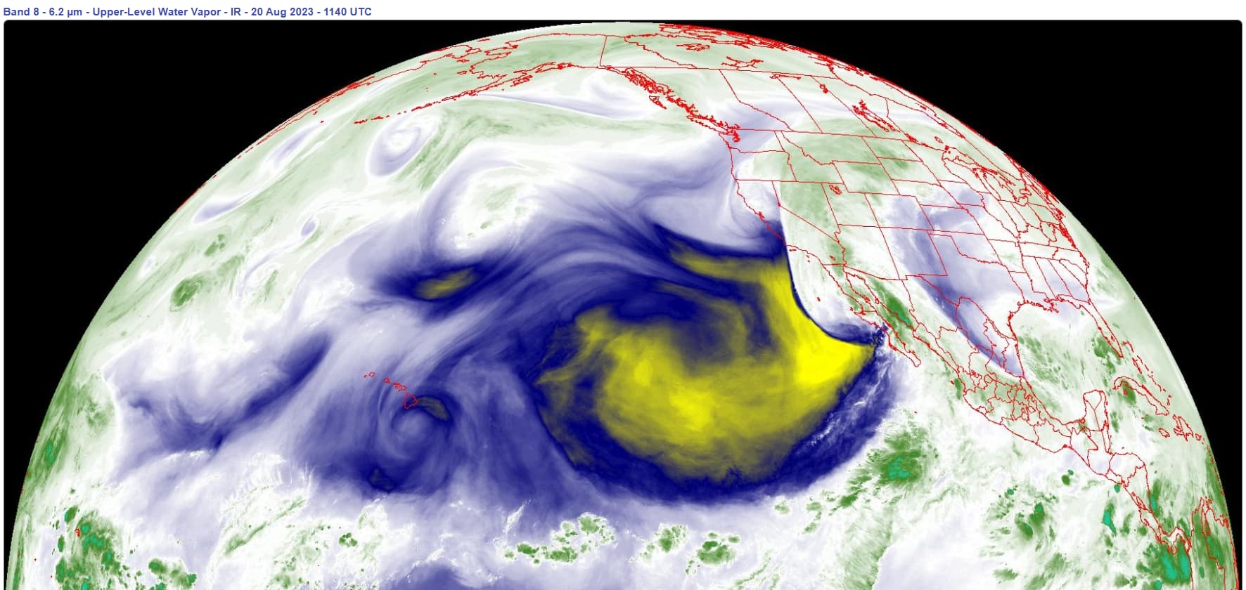
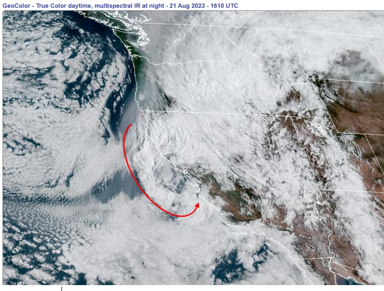
The same can be said of the eastern side of Hiliary, but they didn’t have to amp up the temperature to yellow as the “heat dome” blue seemed enough to complete the wide channel of northward air mass flow. This confinement control is similar to the Lahaina Massacre setup, but with different mechanisms. Again, video (NOAA East Full Disk Band 08) helps one see all this.
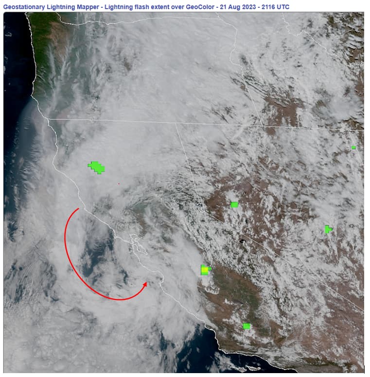
Hilary will deliver flooding and catastrophic damage to Mexico, California, Nevada and Arizona for certain. I expect washed out interstates and numerous flash floods with debris flows. With those highways damaged, the number of escape routes east out of SoCal and Arizona becomes limited. Take out I-5 on the Grapevine and 101 in Santa Barbara to the north, well, the masses become trapped. Let’s also not forget burn areas from the last two years and the record snow fall and subsequent melt off.
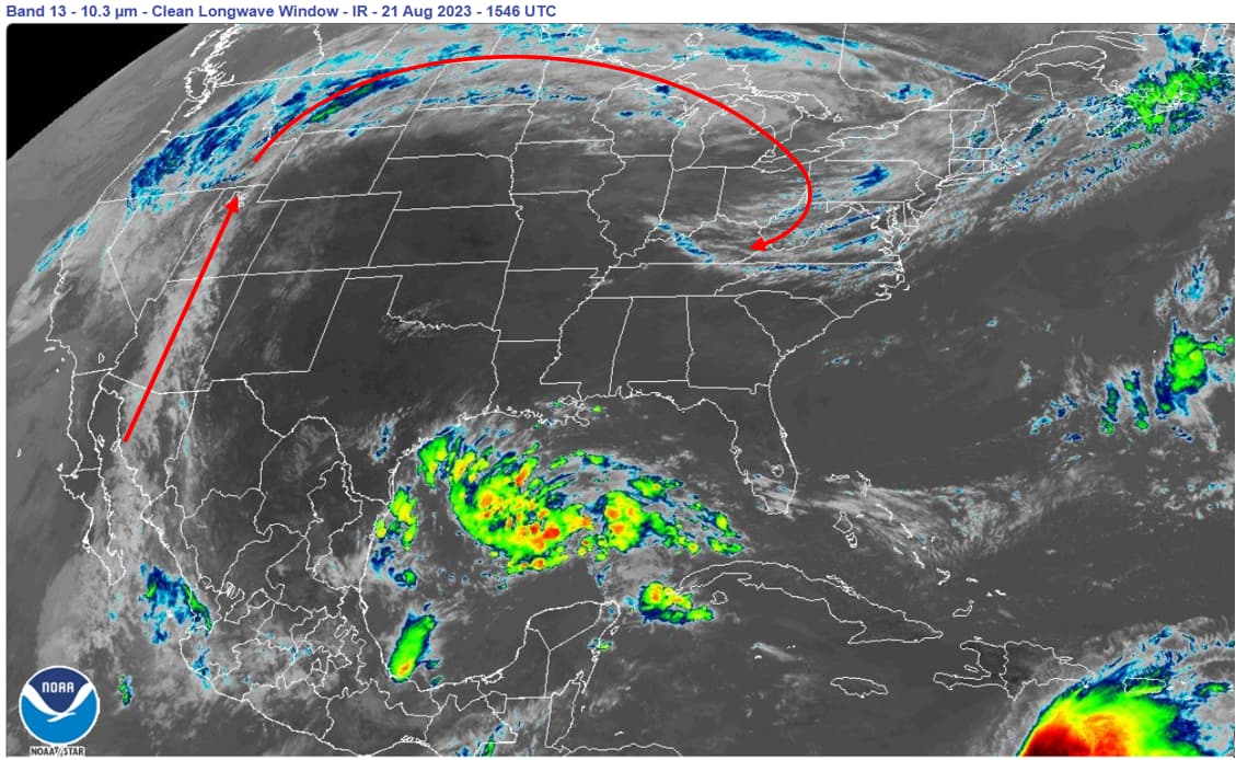
The Hilary setup included a “charged” air mass AHEAD of it that apparently has not released or grown its water vapor. It has reached the voluminous wildfire smoke areas where it will likely mix with the soot for increased size of water vapor molecules as they nucleate. At present, this forerunner of Hilary has been directed east, away from the fires themselves (conveniently); all for some purpose.
Compounding all this are all the moist equatorial air masses that seem headed to the U.S. that could supply large atmospheric rivers.
I’ll write more later.