Impunity from Above

It has been several weeks since my initial post about the daily appearance of fires in eastern Missouri and eastern Arkansas. Except when clouded over, the pattern has been pretty much the same every day, starting at 11:45 local and going until sundown. The IR channel (07) of NOAA GOES satellite stores a new image once every five minutes black represents the hottest surface temp. The dot resolution is 2km in size. When animating the images in a sequence, it looks like the opening theme of the old Lost In Space TV show with the blinking lights (season 1 & 2 mind you). Over the course of six or so hours, there must be 10-20,000 hits, hard to say.

Oh, and let’s not forget there are always weird clouds in the picture, such as the invertebrate type enhanced with yellow/brown to highlight the temperature anomalies.

When one goes to visible channel (02), the plumes of smoke can be seen as well. Animated, the "here a puff, " “there a puff” effect becomes much more dramatic. Red lines highlight the base of each plume, the smoke drifting to the northeast this day. Not all black dots have a discernable plume, makes sense that there is insufficient material to burn at that site.

This is what they look like from the air:


Four fires can be seen in this photo, each base is annotated with a red dot (one is near horizon). EVERYBODY tells me that they are brush fires intentionally set by farmers burning their crop remnants. The EFFECT is most always a “crop fire”, but I still believe the CAUSE to be airborne DEWs of some sort. Note the diameter of the highest (first) smoke (adjacent to blue arrow)… it is huge, circular and quite high. Not all of them are as dramatic as the blue arrow one, it depends on what material is on the ground when the DEW beam hits. ​Perhaps Farmer Bob and nearly every other farmer in the region is an environmentalist and they have trained their cows to emit methane on cue so as to consume the remnants more efficiently. These are very rural counties and I can see why most locals might think they are crop fires from SOMEONE’s farm.

These dots in Arkansas-Missouri region turn on and off like light switches over pretty much the same counties day after day. I guess the other rural counties in the region (Mississippi, Tennesee, western Missouri and Arkansas) didn’t get the memo on training the cows.

Nobody notices, nobody cares. Lassen and Sequoia Natl Parks are all but destroyed. Today’s punching bag is Idaho, but they are occasionally pot-shotting the upper central valley of California (yesterday and today). They, the DEW Masters, can strike with impunity. Don’t forget Santa Rosa (2017), South Lake Tahoe, Greenville (this year), your town, my town, many towns, all towns at the same time. It is not just the dry west that can be the “DEW Site of the Day.” No one is safe.

-PatternGuy (Mr. Nobody)

2 Likes

This is terrific, detailed info, I love it! Stuff like this is SO hard to find these days, so bravo!

Someone documented rashes of fires and earthquakes, looking very much like this, just before and during the gigantic fires in OR and CA summer before this last one. One series of images showed someone making those “dots” in CA in the shape of a smiley face, no kidding. That speaks volumes.

Why shux, m’am. Thank you kindly.

I believe the smiley face. Perhaps there is a secret code in the Jupiter-II dot patterns, I just haven’t studied them well enough. I saw a “007” chemtrail once in the early 2000s. They are rubbing our noses in the collective ignorance. It seems I am late to the dots observation game (via satellites). Been watching the skies since 2018, though.

Idaho this evening

BTW, they are moving some Pacific Pond Scum south a bit to “permit” some weather to come across Northern California (why bless their hearts!). Betcha it is lightning type, just like last August. Summer is over, gotta bring out the fire season tools, you know. BTW, the same type of Pond Scum has kept South America from getting Pacific weather just like California has for months.

Right on cue, a Death Star and minions arrive in scene. Would not want to be in California anywhere at the moment.

-PatternGuy

I would say it is just farmers burning their rice crops. Its turning to fall and most farmers will burn after harvest. I will be flying over it tomorrow morning on my way to Conway from Nashville and will see if there is anything out of the ordinary for this time of year.

I do not believe there are many rice farms in TN. Most are beans or cotton and I have never seen them being burned after harvest.

grahammcb,

Thank you kindly for the reply and opinion on what it might be. You are more familiar with the region; it is helpful to learn what is normal.

With regard to weather, fires and even earthquakes it seems… normal does not always mean natural. Geoengineering on a global scale has been going on for decades now. Weather ceased being normal years ago, despite what Ari and team at the Weather Channel (IBM) tell us daily.

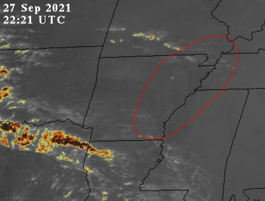
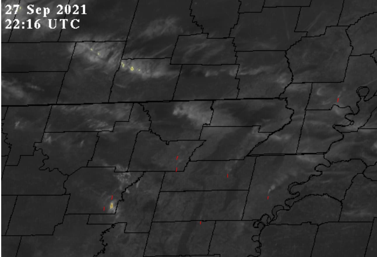
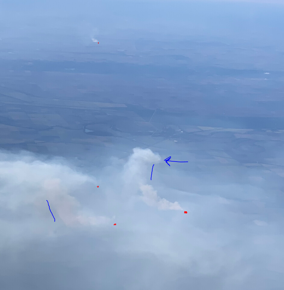
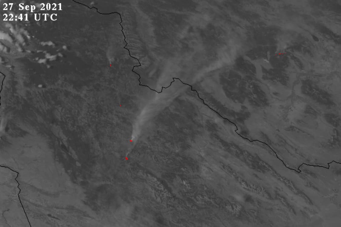
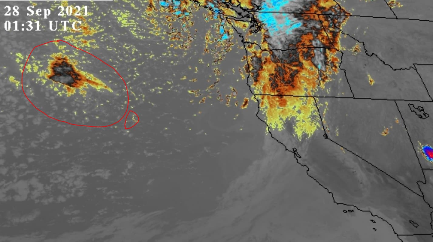
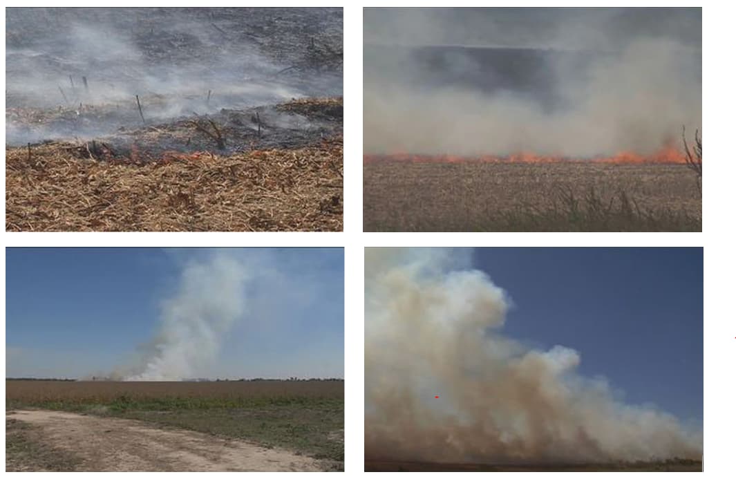
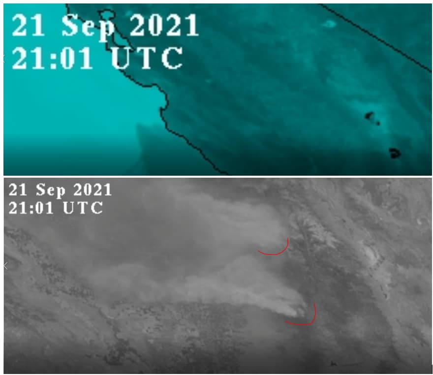
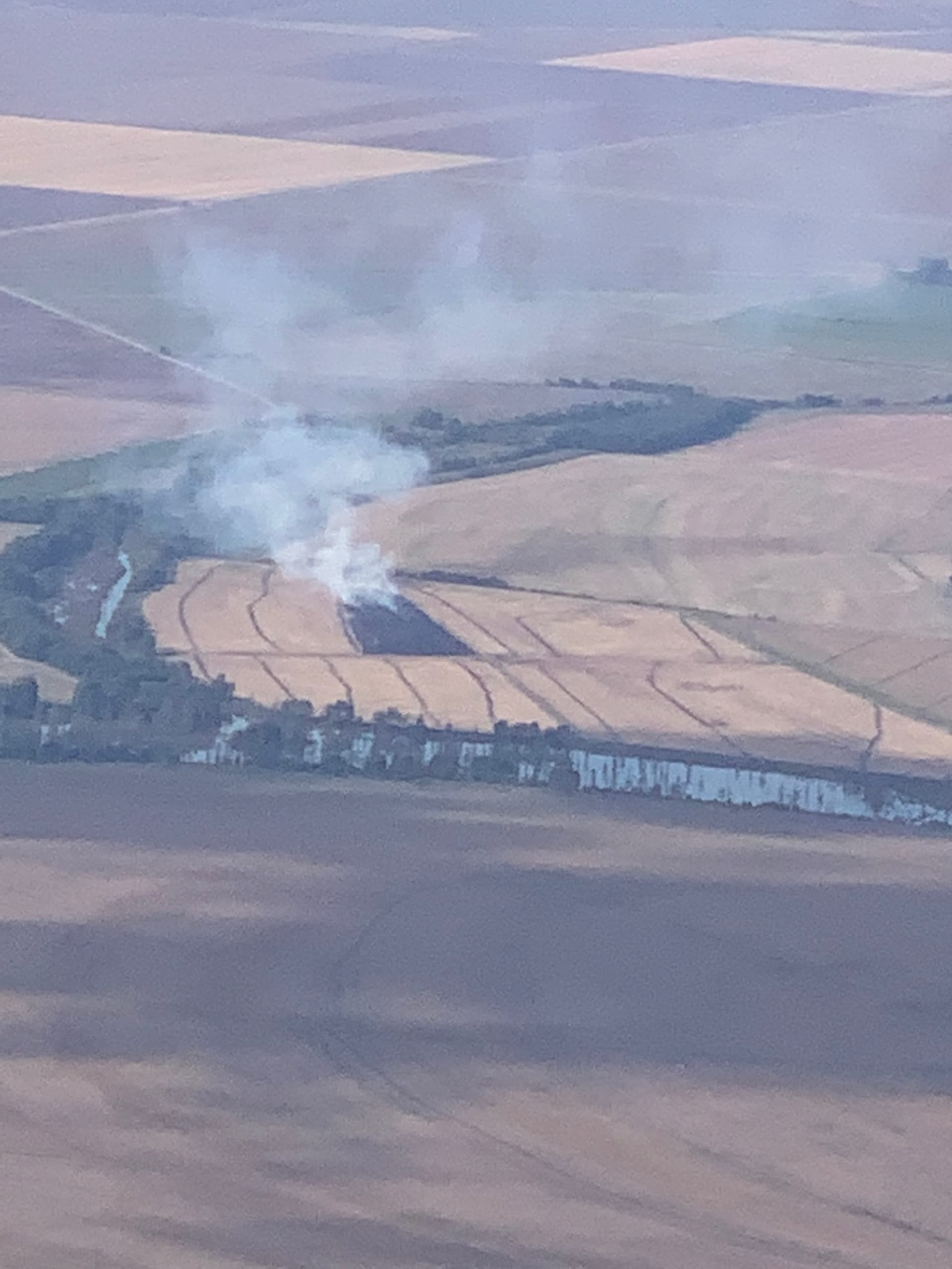
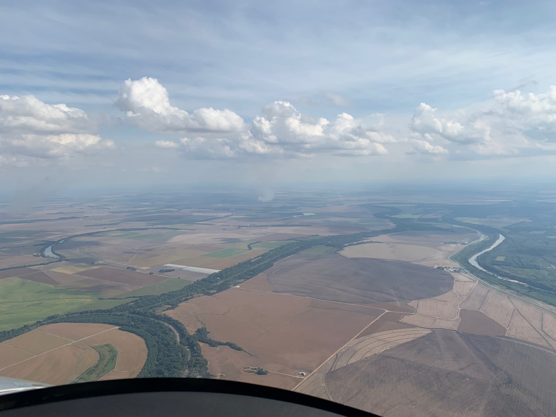
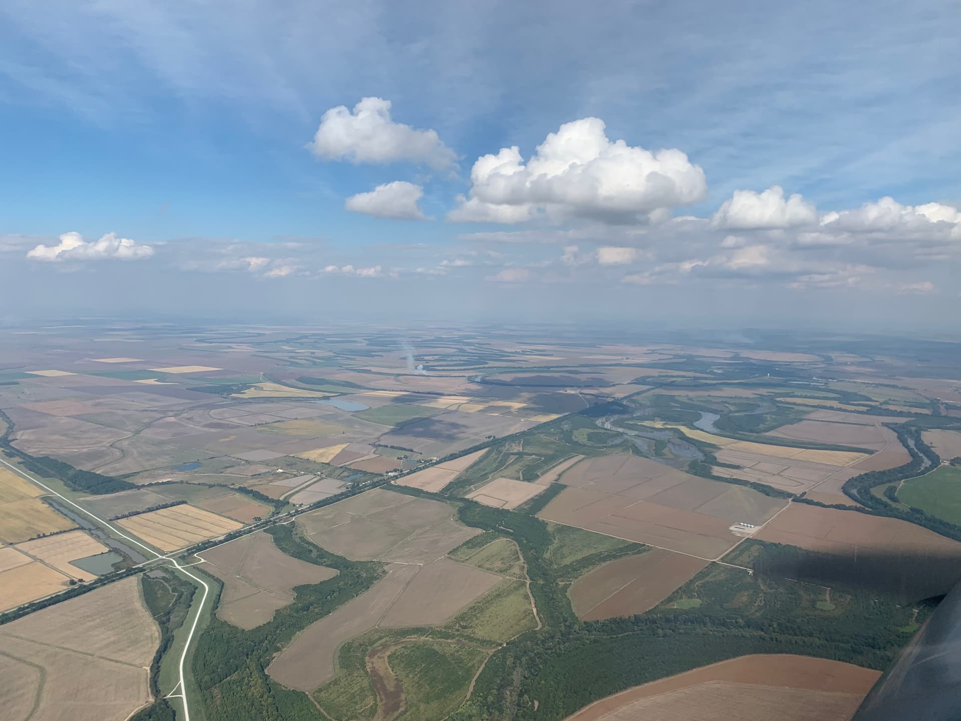
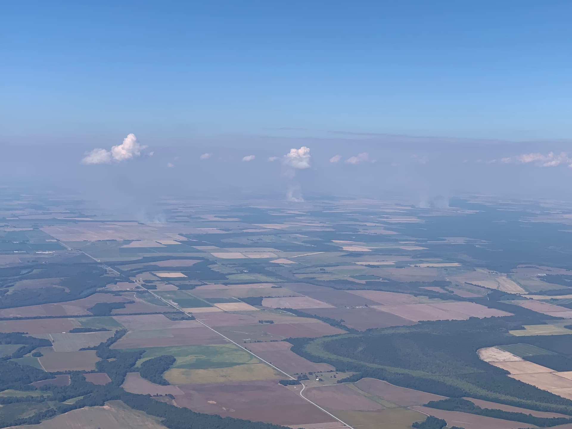
I agree with your expectation that the region will have some crop fires as there are hundreds of thousands of acres with harvested rice crops. Below are some photos from internet of field burning. One has a plume somewhat similar to those supplied to me from a recent flyover, one of which I posted. Also per the internet, burning is cost effective at removing the old organic material and it kills potential pests; both important for the next crop. It makes sense to see fires. But as seen in the other three photos, this is stubble and grass, which have much less mass and will burn quickly and much cooler as compared to raging wildfires that consist of chaparral, dense forest floor brush, and large trees. Grass and stubble fires also burn in a definite line forming a growing region of burnt blackened grass (cooling), the line of active fire (hottest), adjacent to the field of unburnt grass (cold). Of course wind is a factor like always. Also there is speed of the fire. The NOAA images are a series of snapshots taken once every five minutes. The New Madrid black dot images may or may not be preceded by a gray dot. But to go from no dot, to gray dot, to black dot in 15-minutes, with an accompanying tall plume of smoke discernable from the satellite, requires more than a crop fire. Incidentally, some of those days that I saw plumes in the New Madrid area, they were quite windy and in my opinion, very risky for Farmer Bob to even attempt burning. Just my armchair opinion.

I contend that “natural” fires lit by Farmer Bob will not even show up on the NOAA IR image at all; but if one happens to be really roaring, the dot will be a light gray and nowhere near black. After studying the relationship of wildfire plume height, diameter and volatility, some serious heat is required for a black dot. It is matter of the mass temperature, heat persistence/duration and distribution of heat over the 2km surface area. Even today at 12:00 noon the Sequoia Natl Forest fires (KNP, Windy) are still burning with large (but not volcanic) plumes in wind, but are a medium gray dot. My conclusion is they are not being pounded with DEWs today, despite the wind. Black dots mean a lot of surface heat and I contend that even wind-driven forest fires cannot cause black dot conditions without external heat being applied. The KNP-Windy fires last week were sickening to watch (below). These giant sequoias survived hundreds even a thousand years worth of fires and suddenly, this single drought decade (as opposed to others in history) are sufficient to destroy them. Supposedly, these forests were managed, too.

You and other readers do not have to agree with me, nor do I have to prevail in this discussion. I am investing a lot of time to present it to all y’all, if for nothing else, to plant it in the back of your minds, so when something big and bad happens, drawing upon it may help see past the lies you’re being told. We live in the Propaganda Age and I hate it. So hard to see through the lies. It is an evil age.

Presence of black dots in Arkansas and Missouri is not a natural phenomenon; therefore, like weather not being natural anymore, it means man is involved and that is not good. The daily patterns suggest intentionality. I am confident DEWs exist because they are a logical step in weapons development with each nation pursuing advancements so as to not become subject to other nations pursuing the same thing. There is plenty of information on the internet to support this, some from our own defense contractors and the military. They exist. Who has them, who is using them, I don’t know. It is just like the weather. One or more nations has the keys to the weather and they are not benevolent. That is mind blowing, actually.

Weather is the ultimate weapon and we, the United States, are being attacked and we do not even know it. So successful is the Climate Change lie, so easy to lob it at every disaster, so easy now to dismiss those who see behind the curtain as kooks and conspiracy theorists, so easy to provide the solution. Where are those who are supposed to protect us??

Thesis, antithesis, synthesis. Screw-up the weather real bad (secret geoengineering), provide tough, liberty-eliminating solutions (public geoengineering, eliminate oil, coal, crush the US Constitution and its devotees, and whatever else Greta deems appropriate), and control/enslave the world (one world govt, elite and serfs). I actually believe all that… because patterns don’t lie. The Bible, world history, current events, even the lies themselves, all demonstrate where we are headed and a few degrees of global warming CANNOT be responsible for what is going on. Like Covid and vaccines, the lies though, are really, really big.

Admittedly, for all this to be happening, it requires incredible material resources, money, personnel, aircraft, etc., and more than anything, secrecy and propaganda. Other than what information has leaked out on the internet, I have zero proof. I have a lot of satellite data, a lot of photos of weather and chem spraying, from which I draw all these wild conclusions, but I do not have a smoking gun. I don’t care. For those who have eyes to see.

I digress. Back to the intent. DEWs seem to create a lot of surface heat as the energy beam penetrates the surface. Learning that the Arkansas-Missouri hits are along the New Madrid and Reelfoot fault lines was revelatory; many (but not all) of the California fires are on fault lines. Dixie, KNP and Windy were hammered relentlessly with DEWs. The burning (volcanic) forests provide such great cover for use of them to loosen up whatever is deep below. They cannot do that for New Madrid, so it now makes great sense that the daily peppering permits them to hide behind the natural burning.

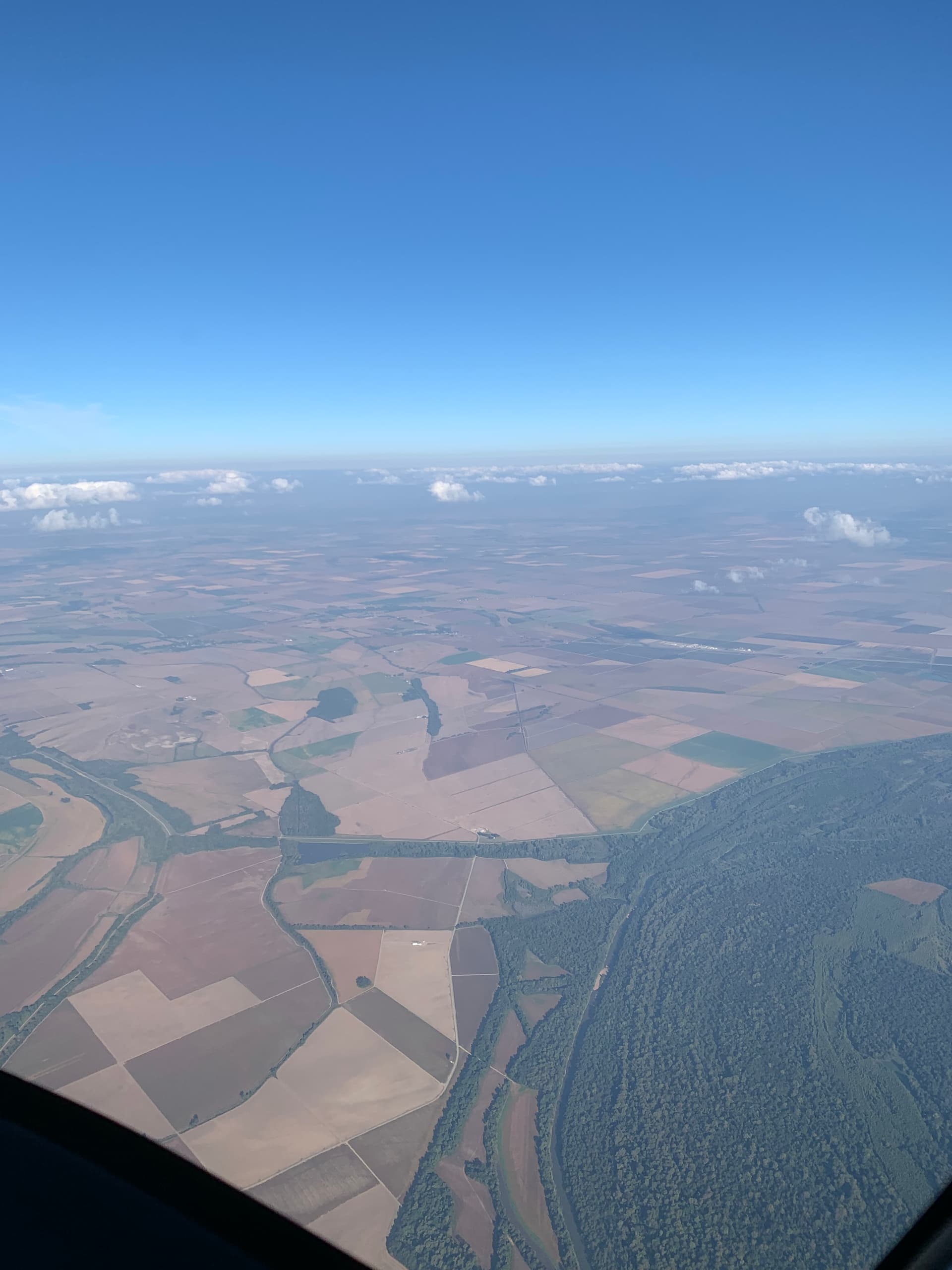
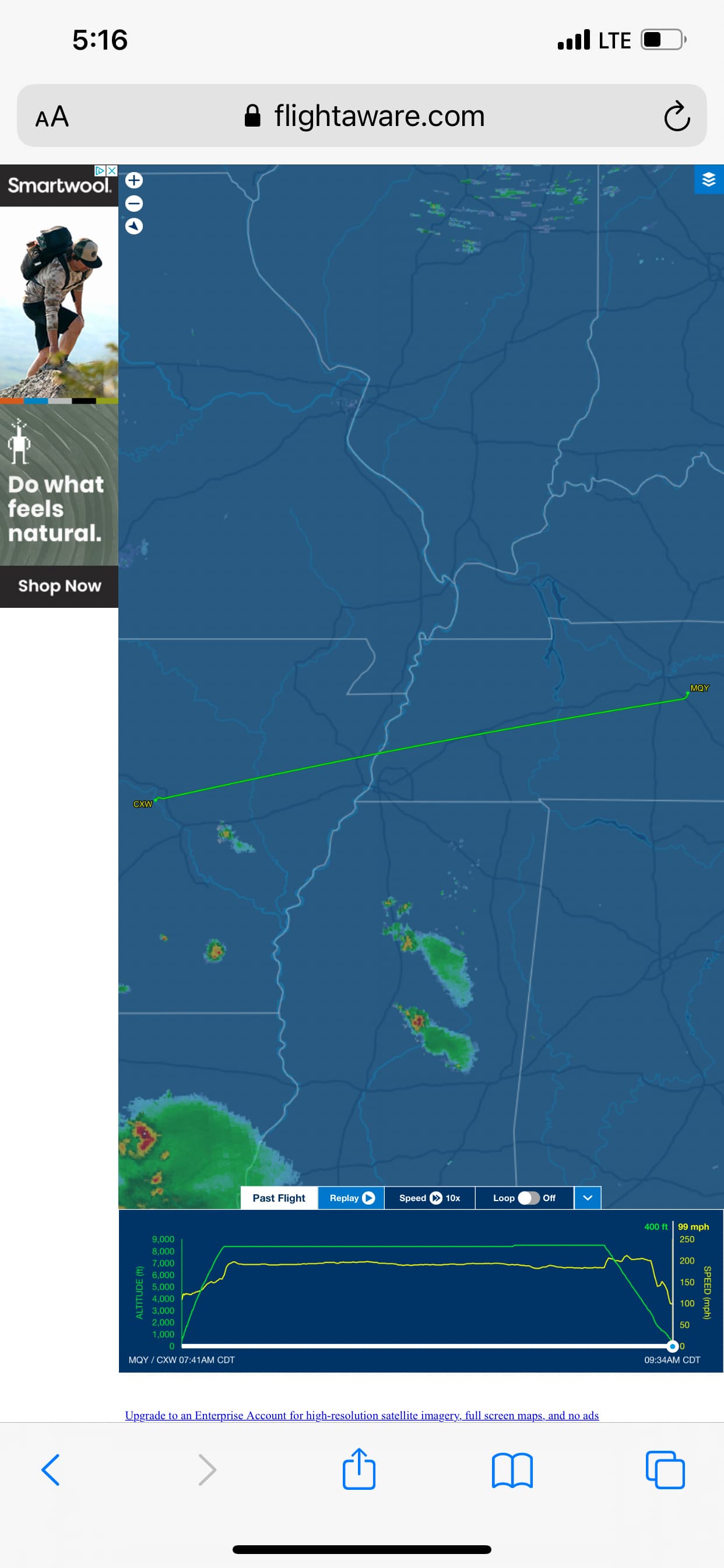
So grahammcb, if the weather today has permitted decent viewing from the air, I hope amongst the many fires (I checked, they are happening) there are a few along your route that are discernably explosive (poof, pop, plume) as compared to the slow starting natural ones. Let us know if you see something that is “out of the ordinary.”

-PatternGuy


At 8:30am at 8,500’ I did not see any fires and skies were pretty clear. I could see about 75nm in all directions. Flying back at 3:30 I counted around 25 fires with around 20nm visibility.

I agree that weather manipulation occurs on many different fronts. These appear to be normal crop fires that I have seen every year though.

@sharick Thanks again for the update, pattern guy. I wonder if you know of dutchsinse? He has been put in you tube jail a few times, but you can still find him there.

He is a self taught earthquake guy who seems to rattle and irritate NOAA to no end. He has been commenting on DEW as to the fires particularly along faultlines in Cali, and I think I recall him speaking of the same on the New Madrid.

You may want to watch some of his videos on earthquake prediction and also videos he made during last years fires to get his take. He’s quite the character, and he’s a home grown Missouri guy!

@grahammcb Welcome to the forum! You may also want to check out dutchsinse if you’re interested in what pattern guy is reporting

Thank you kindly for supplying taking the photos and posting them; they are very instructive. I see your flight path took you near Shelby Forest north of Memphis; it brings back memories from being there years ago at the boat landing a few times. The black dots do not arrive until late morning (reason for no fires on first leg). Perhaps there is a mandate in both Arkansas and Missouri to restrict when the fires can be started; although I cannot see why that would be necessary.

At this moment, I am unable to associate the fires in your photos with specific black dots from satellite images. That last image; however, with some study, should help me identify the location of one or two of the fires. There are a lot of fields and indeed, a lot of crop fires going on. I cannot draw any definite conclusions from these pics, either.

  • There are many fires in this area, all assumed to be crop fires.
  • Most appear small in terms of acreage, temperature and smoke.
  • A few large ones (e.g., last photo, most distant on right, 4th photo center) dwarf others in size of smoke plume and active fire line.
  • It is hard to tell how many individual fires exist in the smoke clouds

Armed with both sets of airborne crop fire photos (unsynchronized with satellite data), it seems plausible that multiple adjacent NATURAL crop fires burning hot within the 2km (resolution of the NOAA IR sensor) could register as a brief light gray dot, of which there are many over the course of a day in that region. These plumes are not discernable on the NOAA visible image. That is as far as I can stretch on natural crop fires and dots.

The larger crop fire plumes I am still convinced correspond to the black IR dots. I don’t believe stalks, grass and stubble can naturally get very hot as compared to burning trees and chaparral. My reason for holding fast is the forest fires themselves. Weather over Southern California is clearer today. Below are the KNP and Windy fire IR and visible images. Remember, some of these trees are LARGE in diameter. Both fires are still raging at the fire lines and are generating wind driven smoke plumes; however, the IR dots are barely discernable if present at all and the plumes are miniscule as compared to the volcanic ones seen in the Sep 21 photos above. Red lines were placed next to the plumes, wind is heading SE.

I still contend that a black dot in a Arkansas-Missouri field means the same thing as those for California wildfires–enormous energy is being applied to land surfaces, including soil, generating sufficient heat to register as a solid black dot. The other factor is presence of the specific chem clouds (from other NOAA images) and seen in the latest photos above the puffy white clouds).

In the absence of feet/drone visuals at ground zero that are coordinated with satellite image data and timestamps, I am still short on evidence to support the supposition that DEWs are being beamed into fields along the New Madrid fault line. Incidentally, I hope I am wrong, but I will stick with what my patterns tell me. Perhaps I should take up palm reading.

Once again grahammcb, thank you for expending the time, attention and energy on behalf of me and other readers. Seeing it from the air like this is so helpful, as it eliminated some false perceptions in my mind. It was very generous of you.

-PatternGuy

nperpetuity,

Thank you for the suggestion. No, I had not heard of ducthsinse. I started watching his earthquake waves video and found it quite interesting. Another pattern guy it seems. I plan to examine more of his videos. Glad to know I am not alone in connecting the dots, pun intended.

-PatternGuy