
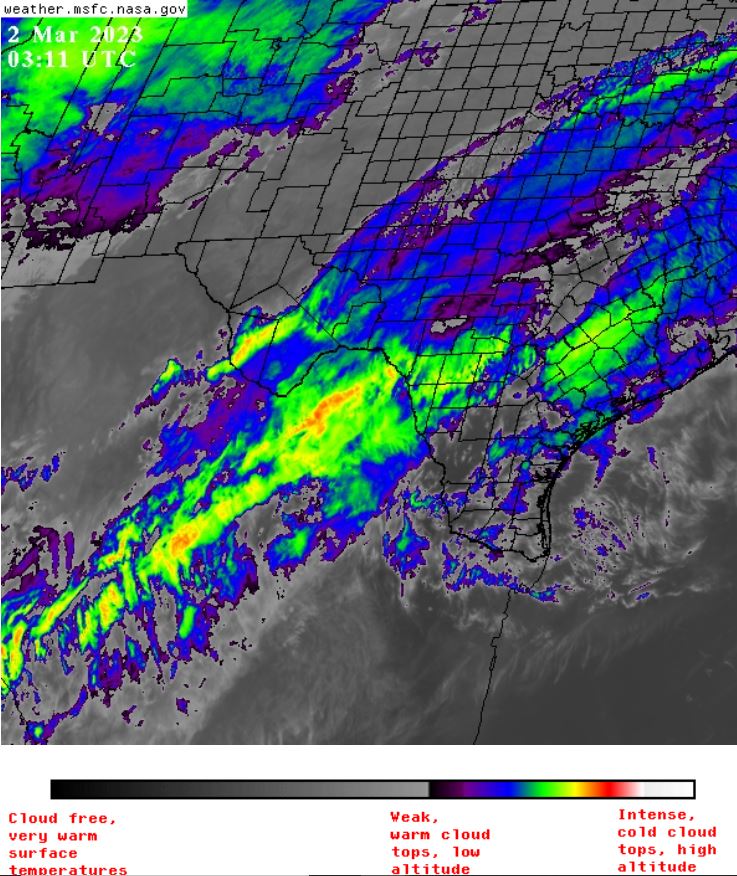
Just watching weather patterns this evening and noticed one of the most rapid and concentrated thunderhead clouds I’ve ever seen form in South Texas. In the space of one hour and within the space of one county, an ultra-cold air mass developed.
The first image is at 03:11 UTC
.
.
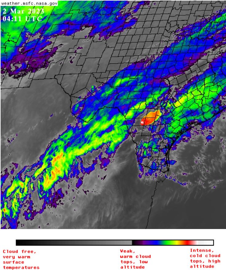
And the second at 04:11 UTC, one can see the white dot within the red.
.
.
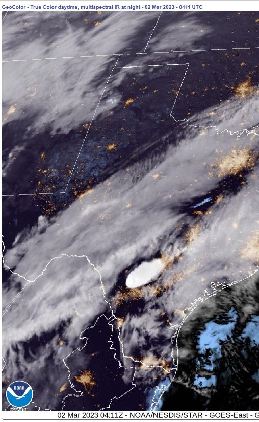
The GeoColor image over at NOAA (04:11 UTC)
What natural force(s) can cause such a rapid rise in heat (which in turn cause the updrafts that produce very high clouds)? I say none can. There was no lead in, no gradual turning from green, to yellow, to red, over a larger area. This just blipped into existence almost instantly.
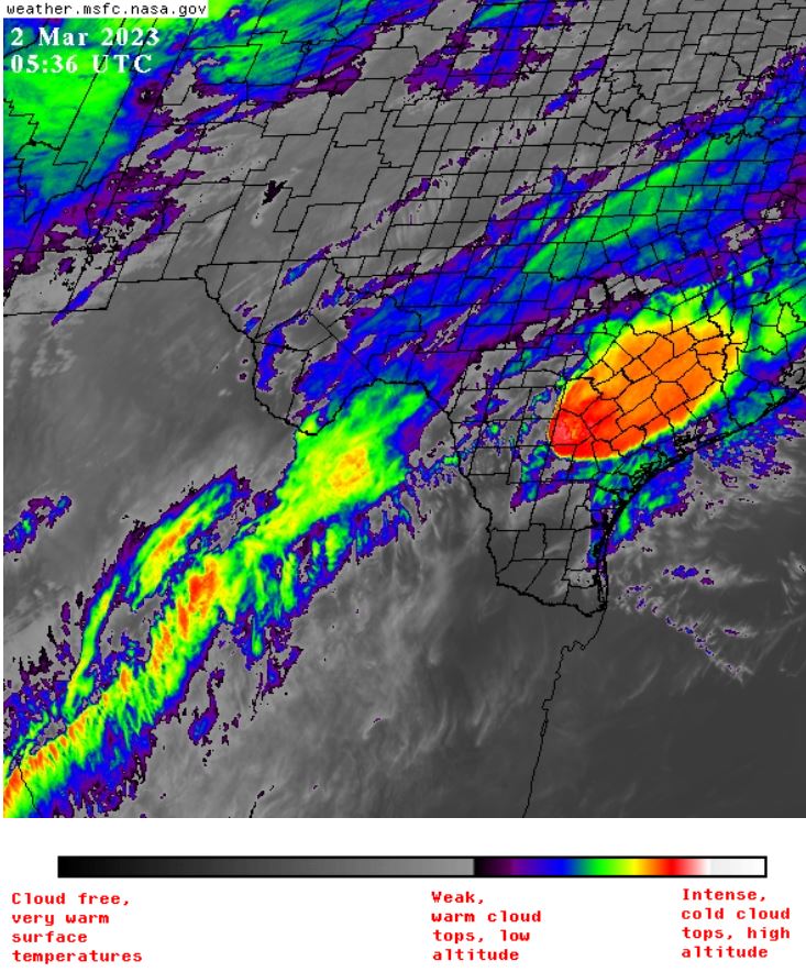
Now, at 05:36 UTC, it has developed into a much bigger storm (in red) without the colder, higher (white) clouds.
.
.
Even more dramatic in the composite Air Mass RGB
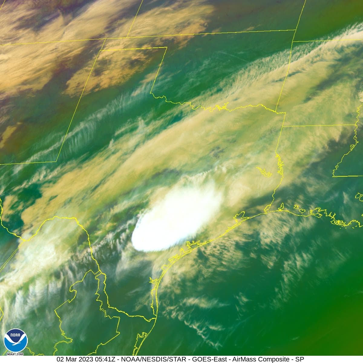
“They” continue to refine their craft.