
Haha. Let’s pretend that geoengineering doesn’t exist, denounce it as conspiracy, then act very surprised and interested at some of the consequential phenomena, like it was new.
This along with other climate change combat activities (e.g., Bill Gates funding of research into aerosol spraying to cool the planet, etc.) will advance the Chicken Little narratives that the sky is falling because of cows and CO2.
The posted video concentrates on the surreal and flashy blue jets and sprites, but ignores the nagging question of just how did these towering (and thus very cold) clouds form as they did?
I recently caught this massive cloud (below) erupting, yes, erupting from near the eye of Hurricane Ian at sunset near Cuba.
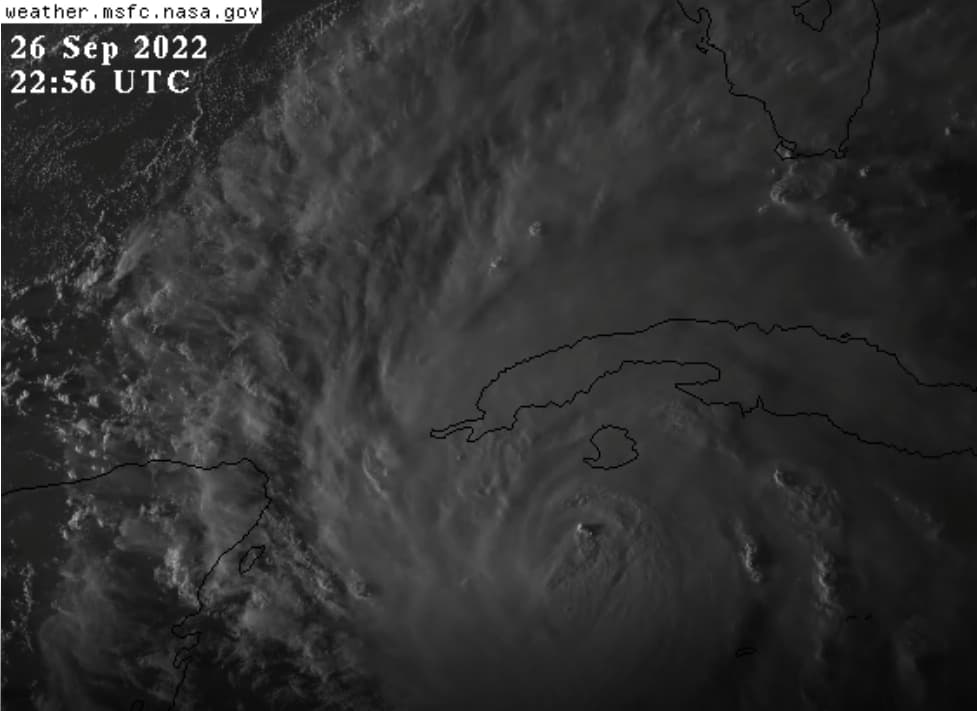
Note the UTC time; it is 22:56 and something begins climbing out of what is supposed to be the eye of the hurricane (south of the western end of Cuba). (Note: There was no hint of anything at 22:51, it was flat.) There are other clouds bubbling up, but nothing like this one.
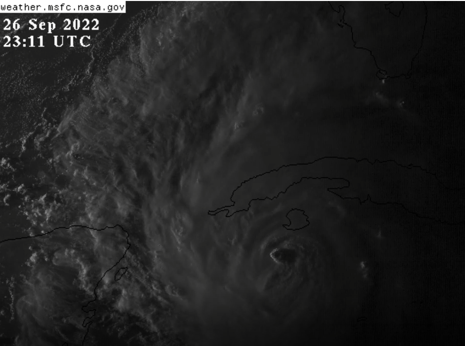
A mere 15 minutes later this cloud is still shooting upward.
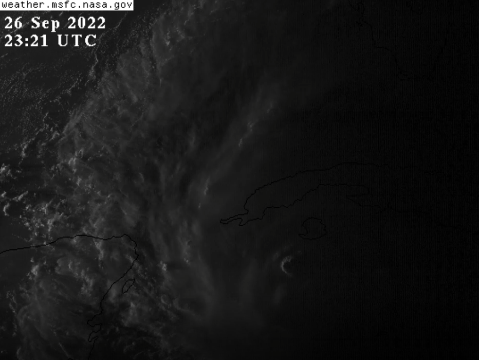
The bad thing about nighttime is that clouds are no longer visible. The good thing about sunset, though, is that it really emphasizes elevation of clouds. This thing was massive and explosive! In the space of 30-minutes, this super cloud comes shooting up out of a rotating hurricane (supposed) eyewall.
My question is… where did the energy come from? There had to be a force to cause a such vicious “updraft” and form such a cold and towering thunderhead. In the middle of a hurricane over open water where there aren’t any land features to excuse the heat needed for vertical cloud formation.
Perhaps they needed it to look like there was an eye. After dark of course.
The posted video is normalizing the abnormal. Those blue jets and sprites are outcomes of geoengineering. They aren’t new nor are they natural.
-The Pattern Guy
Heating is most likely due to the water temperature, which at this time of the year is near its maximum high in the Gulf. Then as the warmer, moisture laden air comes into contact with the colder air in the upper atmosphere is condenses into clouds.
In just one spot, say ten miles wide (doesn’t matter), are you suggesting there can be such a concentration hotter water, that in a raging homogenous ocean where the sun is not shining, that evaporation occurs quickly enough in such a way the warmer water vapor can remain intact and rise vertically thousands of feet in rotating hurricane force winds? I strongly, but politely, disagree.
Think of how hurricanes form. The center is mostly calm, with walls of a swirling mass of winds that reach a velocity of 120 mph.
I agree that the eye is mostly calm, and the eye wall is composed of high-velocity winds, just as you describe.
But a tropical storm/hurricane is a homogenous, swirling mass in which lower layers absorb warmer water vapor present in the region, increasing the instability and strength of the storm. How can a pocket or column of evaporated water vapor survive those preceding, violent surface conditions and remain sufficiently warm so as to create the sudden vertical column that towered over the top of the hurricane itself? Even if it came out of a wide and well-defined eye, I would not believe it a natural process.
You can’t get blood from a turnip–energy was added from some external source, and I contend that the blue streaks shown in the video might very well be that source.
Nidster, we can agree to disagree.
Oh, sure thing! Always helpful to have another view, and I will agree that you presented a plausible alternative. Thanks!
EDIT – Your response also trigged my memory about Hurricane Sandy, and HARP being used to ‘steer’ and intensify that storm. The movie ‘The Perfect Storm’ was modeled on that hurricane. I’ll dig through my old posts I made on the Forum years ago, but first I need to get some sleep as I have an important appointment to keep early tomorrow.