
4 Likes
A corporate structure mirroring monarchical chess pieces on a chess board.
1 Like
And the chess game continues … until checkmate.
2 Likes
Аnd then what?
A brand new game?
2 Likes
It has always been thus…
@beaver: I found the video to be informative; thank you for posting.
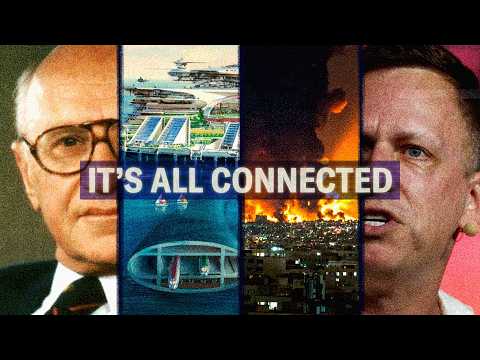
At the 09:05 mark they start talking about a new economic regulatory zone involving the former U.S. military facilities at Subic Bay Naval Station (includes Cubi Pt) and Clark Air Force Base.
“Just last week, we signed a historic deal with the Philippines, 4000 acres right next to Subic Bay, where we’re going to build a first-of-its-kind, AI-native industrial park.”
This article provides additional details:
Pax Silica’s Luzon gambit | Troi Santos
"A 4,000‑acre AI‑native hub in New Clark City turns Philippine minerals, ports, and engineers into a programmable asset on Washington’s AI balance sheet—testing how far Manila is willing to go from customer to co‑owner in an American‑designed supply‑chain stack. "
1 Like
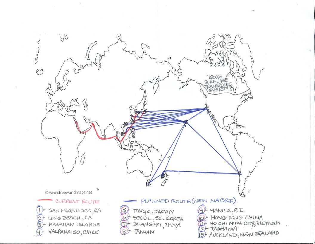
I noticed item-9 on your map on one of your previous posts. Even then I thought Subic would have been a better choice, given the infrastructure there (deep-draft piers, large runway, hangars, etc.), but lacked evidence of any plans until you posted the video above.
Maybe “Luzon, Philippines” would be a better description for the next revision of the map; just a thought. 
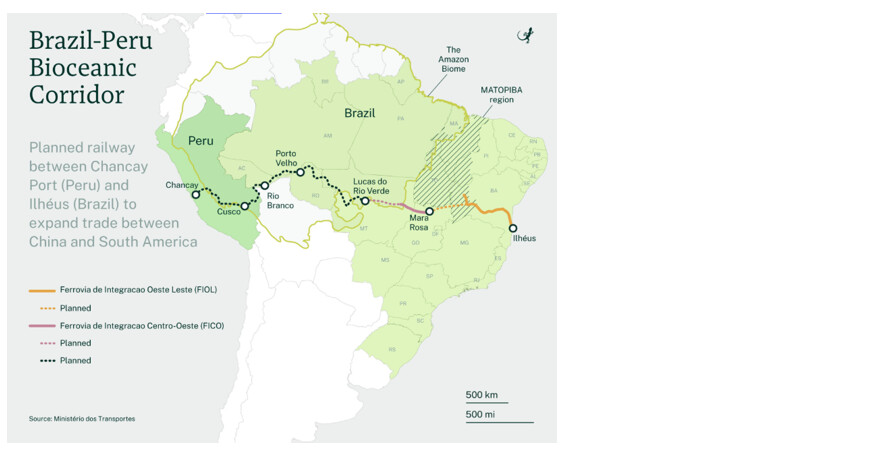
Also, please consider whether adding Peru to the map (in light of plans for the Brazil-Peru Bioceanic Corridor) would apply to your diagram.
There are only a couple of locations that I feel I can determine exactly, for now. San Francisco, which will and is the U.S. hub of AI, location is Pier 31 which is protected from the elements, Long Beach/San Diego, The H.I., esp. Oahu on the opposite side of Pearl Harbor, Lahaina, and a couple off the coast of Kauai.
With regard to So. America, Chile has a special relationship with The U.S. and much of the rest of the shipping world and Valparaiso is well-known. I did not include Brazil in any way because it’s a BRICS nation; this doesn’t mean there won’t be connection in the future, only that it’s not a part of The North American BRI. The 1500 mile burn line across Canada is more likely to become the Atlantic/Pacific connection. (USMCA)
I’ve posted videos, pictures & maps on this site for a number of years regarding all this. This is The NABRI, not a comprehensive global structure hypothesis.
2 Likes
Thank you for clarifying the map purpose and scope (NA Belt Road Initiative). I have read many, but not all of your posts; being a bear of little brain, I didn’t keep track of it all very well, haha.
Living in the East Bay, we didn’t travel inside San Francisco often, especially on foot; however, in 2008 I attended a week-long automation class on lower Lombard St. It was October with warm and sunny weather (typical at that time of year), very pleasant. Each day I walked from the Embarcadero BART (train) station to Pier 31 along the waterfront starting at Pier 1. Even at 7:00 in the morning it was safe to do as there were many others biking and exercising there. San Francisco then was not a perfect city by any means, but it truly was beautiful and very unique with its buildings, skyline and terrain, not to mention things like cable cars. For the last day of class, we ate at Houston’s, just across the street from Pier 31.
Thank you for the memory trigger; it was a better time.

1 Like