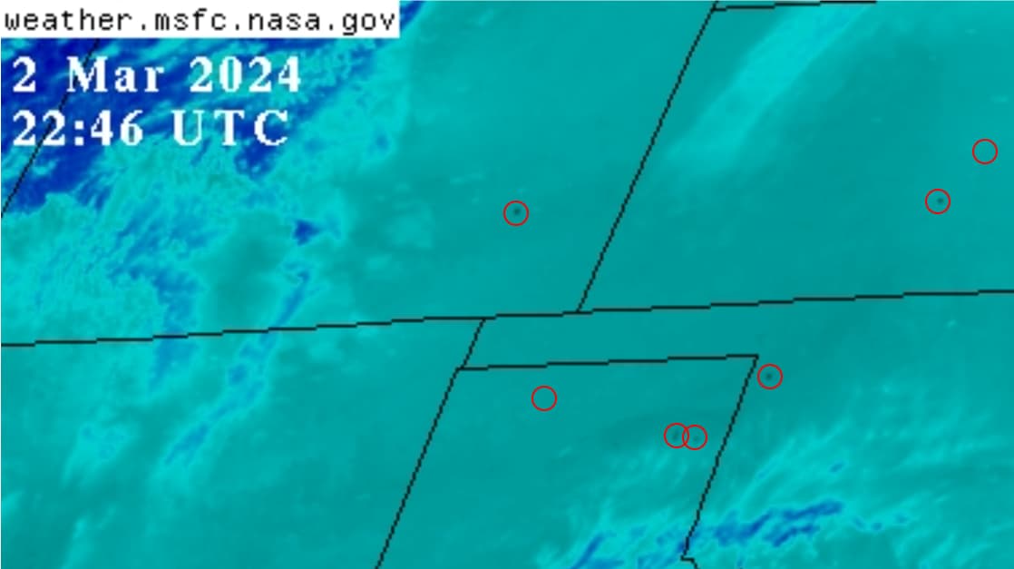
A-17:01z El Paso County, CO
B-17:06z Prowers County, CO
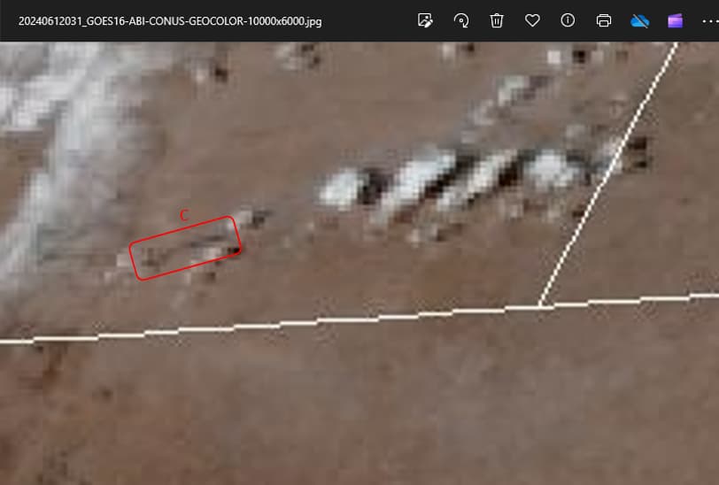
C-18:41z Laramie County, WY
D-18:41z Barton County, MO
E-18:56z Greenwood County, KS
F-20:51z Gage, County, NE
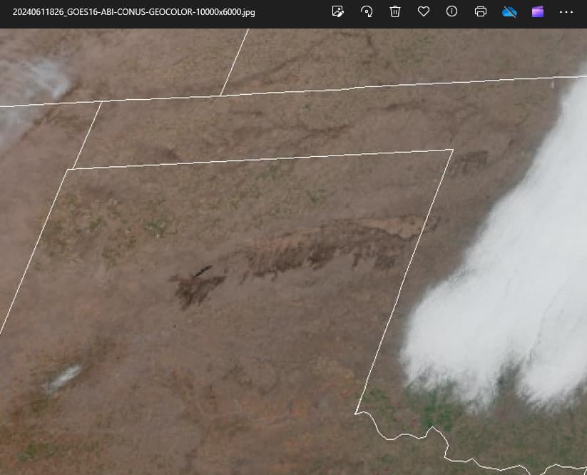
Blinking black dots appeared as listed. Timestamps (in universal or “zulu” time) are of first instances of the hottest infrared surface temp level as reported by NOAA satellite imagery. Areas marked numerically are the very large, but cool and quiet burn scars in Texas, Oklahoma and Nebraska.
With the Weather Channel and other mouthpieces projecting high fire danger, I thought I would get a head start on what may or may not happen in the Central Plains this weekend.
Meanwhile, the “uncontained” (per MSM online headlines) Texas fires show very, very little smoke and non-discernable surface temperatures.
Sharik, you’ve posted these findings several times. Seems your premise is that someone is ‘doing this’ intentionally. Let’s do some speculation on some questions (who, how, why).
Who: state actors, non-state actors? US owned, or Chinese, or?
How: satellites, or ground based (HAARP style), or nit-wits with matches? There were posts related to the Maui fires that posited the Chinese have lifted heavy enough satellites to produce the energy needed to start fires. if this is the source, you should be able to track satellite traffic over the areas affected and correlate as did the analyst who posted speculation of the Maui fires. Some seem to think HAARP type devices could do that, but directing narrow beams of energy across long distances with enough intensity to start a fire seems doubtful. Phased array beam control just isn’t that good I think. HAARP bounces energy off the ionosphere, like AM/HAM radio skip and lands the energy hundreds of miles away. You can determine how far radio waves skip (ask a HAM operator) and using at least two geographically separated ‘targets’ pinpoint the origin like radio direction finding in reverse. But I think the HAARP method is not really feasible.
Why: IDK why someone would use spendy infrastructure like HAARP or satellites to set fires in the middle of no-where. The Maui fires do seem to have some motivation to them. But NW Texas? Nothing there but scrub brush to burn…now if they were burning producing wheat fields, or prime real estate they want to re-develop, that’s a different thing. Are they ‘de-bugging’ or fine tuning a weapon system? Or are they ‘sending a message’ that they can do this anywhere they choose to? Why would the Chinese (or anyone) care to set fires in the remote locations shown? Are the Chinese leasing satellite time to some non-state entity? If so why would they spend leased time this way?
To mature your thesis beyond ‘Hey look at this’ you need to try and find the source of energy that’s doing it.
To be clear, my premise is “Unnatural Fire Propagation”
Let’s do that. Yes.
I do not know and almost… I almost don’t care. The U.S. government (and many state governments, unfortunately) are thoroughly compromised and corrupted. “Deep State” if you will. At the moment, our borders are wide open and thus permitting innumerable people coming into the country that have great potential to inflict severe harm upon people, businesses, structures, utilities, water sources, transportation, etc. That is just one of the many threats we in the U.S. face today, incrementally preceded by offshore manufacturing, unending entertainment, legislated restrictions, international treaties, material and labor shortages, excessive spending and debt, social engineering, and so on. We could both name more, so that should suffice.
If our own government repeatedly: (1) Fails to uphold duties cited under, and violates limitations imposed by, its charter (The Constitution); (2) Creates legislation and executive orders that: a) favor hostile nations and global agencies, but b) Simultaneously diminishes the liberty, safety, wealth, and wellbeing of its own citizens; (3) Lies, deceives and obfuscates as a matter of routine; and (4) Wields an unprecedented cache of society-controlling weapons; well then, to use one infamous quote, “What difference does it make?”
Regardless if it is the U.S., China or a host of other nations, corporations, or ultra-national bodies or most likely, all of them together, what chance do we have of really finding out Who is doing this, much less stop them?
It (Fire Propagation) could be perpetrated through weather wars with many players or one big AI-driven system. I don’t know Who for certain, but I am confident the U.S. government is involved, at least to the point of not stopping it. Narratives from the U.N., NOAA, WMO, and a whole host of entities touting the climate change, seem to be intertwined and well organized.
How what? How are fires started or how are they perpetuated?
I draw a heavy line of distinction between them.
Like I answered in Who, How the fires Start, so far, has not concerned me. Past causes (some are poor scapegoats) have been assigned to utility companies (PG&E in California), vagrants and arsonists (Fawn Fire, Cache Fire, Forest Hill Bridge Fire), lightning strikes, vehicle fires, machinery failure, and prescribed burns, while other fire causes remain unknown.
How the fire started does not relate at all to how the fire burned, how it is so unnaturally perpetuated and intensified. With each of these fires, it is the same story, over and over again. Most folks seem to accept the repetition, spontaneity, and severity of fires without ever considering that they are not burning naturally. We have been conditioned to accept top-down narratives it seems.
Although Dr. Farrell speculated on the possibility of directed energy being used (in his response to Lahaina), in his summary he cited unmanaged vegetation condition as primary factor for the fire’s severity (my wording). I believe, respectfully, that he missed the ball. Take away that unknown heat source, the one that burns metals, melts alloy wheels and windshield glass, but not nearby trees, take that out of the equation and there is no longer a catastrophe—in every one of these tragic fires.
Thank you for the suggestion to do like the correspondent, but no thank you, as it would be a waste of time. I liken it to others who suggested I look at air traffic websites to see which aircraft could be spewing trails overhead. I don’t think that is the mechanism and it is not my gig, tracking satellites.
I am not looking for a nit-wit with matches; I am just reporting there is “someone with an invisible flamethrower… again” if you will, as it is not just the wind and fuel. Right now, most everyone seems on board with narratives, like the one about a hurricane 700 miles away from Maui caused the big winds there. Wind… it is always the wind. And dry conditions. Wind, dry conditions and even lack of water can’t explain a fire truck being consumed (consumed, nothing left but ashes!) while combustibles nearby survived. Impossible naturally.
Thus far, Lahaina has been the most egregious Fire Propagation event. It was in-your-face unnatural; so much evidence clearly seen on camera, from satellite imagery, MSM weather and fire narratives, not to mention the cover-ups and property scheme revelations that came after. The speed, selectivity, synchronicity, ferocity, and unpredictability of that fire is so similar to those preceding it, but the public location, loss of life, and damage to property, has already overshadowed similar but almost-forgotten fires in Santa Rosa, Ca (2017), Greenville, Ca (2021) and Marshall, Co (2022).
Santa Rosa was a jaw-dropper when photos emerged that Monday morning. I raised a family in the Bay Area years ago (have since moved out) and it was a big deal then. A little closer to home a less-known fire near Vacaville, California in which a colleague lost his entire home. These and the later '21 western wildfires galvanized my attention and thus facilitated my growing discernment of Fire Propagation patterns.
It has become a scorched earth, baby. As Charles Spurgeon once said, “Discernment is not knowing right from wrong. It is knowing right from almost-right.”
Patterns don’t lie, but people do.
Some, but not me. I have not once implied or stated that HAARP is part of a Fire Propagation energy source. There is more to HAARP than what you described, and I elaborate a little bit more below.
I politely disagree. Please keep reading.
I was an avionics type in the military and am quite familiar with radar (microwave) and various HF, VHF and UHF radio systems, at least as they existed in my day. I even roomed with an amateur radio enthusiast for a couple of years, and so am fully aware of the skipping nature of various radio wavelengths.
Mentioning low-frequency radio wave skipping while discussing HAARP (microwave range) feasibility is not a good analogy in my opinion. There is so much more to ionization of the atmosphere than what we have so far touched upon; HAARP is but one string on a previous edition piano.
Nor do I, at least in regard to Fire Propagation. HAARP is 30+ year-old technology with an antenna array that is quite large, difficult to hide and cannot be deployed. Geoengineering types didn’t start with HAARP, nor were they content to stay with HAARP.
The technologies utilized now are so much more advanced and are deployed daily across the globe to effect Climate Engineering, Weather Manipulation and Fire Propagation activities, to name a few.
I cannot recommend enough two sources that have done the heavy lifting on geoengineering research. The physics, history, secrecy, technologies, patents, agencies, programs, systems, corporations, experiments, and some named people, that these authors have revealed, helped me greatly with all of this. I wish I had them sooner.
The movie entitled, “The Dimming” by Dane Wiggington at geoengineeringwatch.org is free and the best I have seen to date. It is a great technical primer (but not too technical) regarding geoengineering with chemtrails, various energy sources and experiments covered.
The other is a three-book set by Elana Freeland, which cost me $60 on Amazon when I got them. She does a masterful job compartmentalizing complex information and presenting it in a cogent manner. If only one book, get “Under an Ionized Sky.”
Nanoparticles in clouds play a big part of this. So does organizing the troposphere into levels and having multiple chemical compositions in the spray mix. Although I haven’t talked about it much here, I believe clouds are the energy delivery mechanisms. Elana covers those topics, too. Understand that she goes far beyond fires and weather; actually, all the way to transhumanism. Very informative reading, buckle up if you buy.
Oh, and I must not forget Robert Brame. He has done a lot of research. He has visited at least 38 fire sites in northern California. An amateur botanist and avid hiker, he knows trees, foliage and has seen his share of pre-2017 forest fires and their damage. His photographic evidence of application of directed microwave energy at all but three sites is most compelling.
Why: IDK why someone would use spendy infrastructure like HAARP or satellites to set fires in the middle of no-where.
I would state it like this:
With a weapon system such as this, why would they only scorch thousands of rural square miles all over the earth while only occasionally burn cities?
My answer: I do not know, maybe they’re not ready yet.
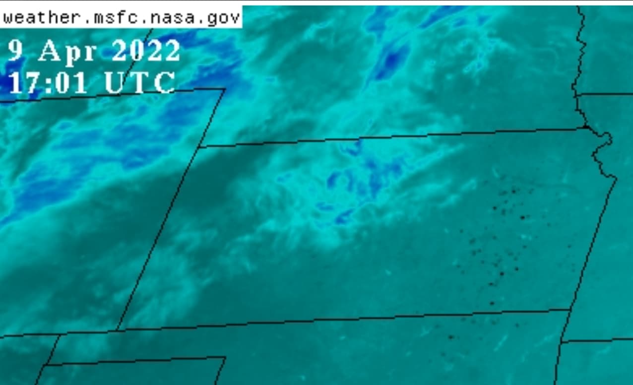
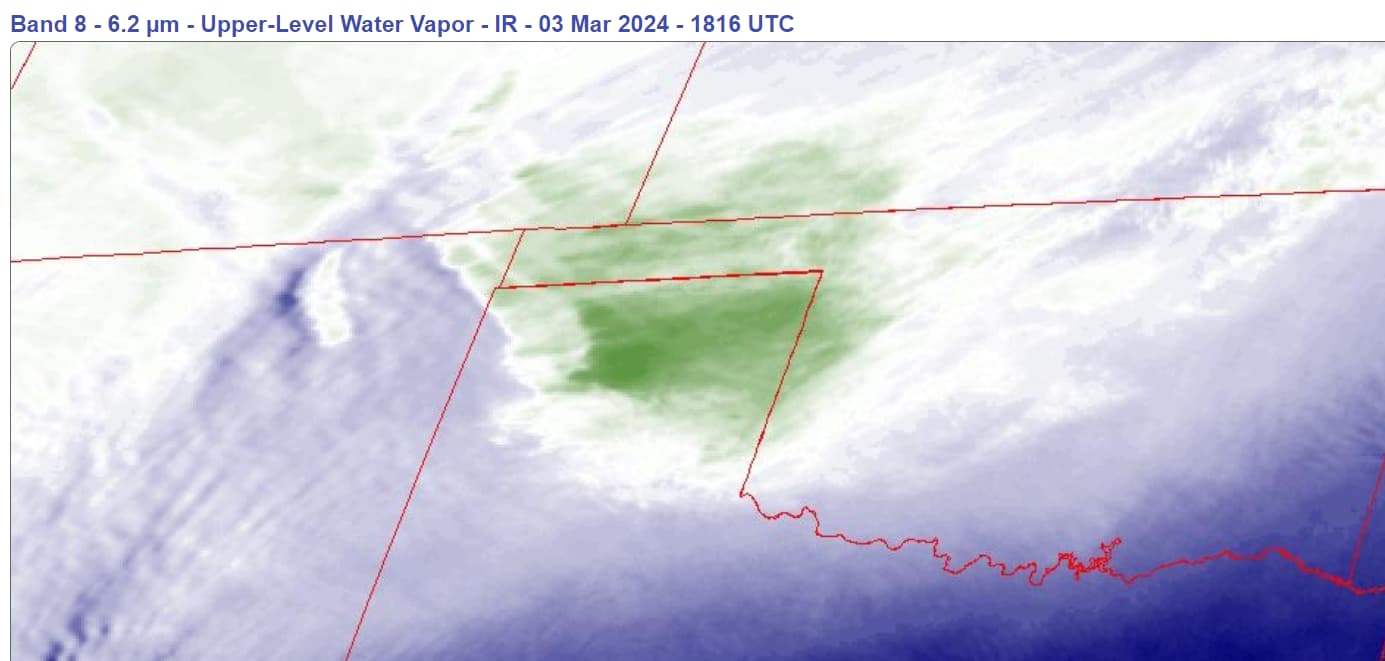
Like Weather Control, there are patterns of Fire Propagation that could be interpreted as being practice runs. Eastern Kansas infared imagery in April of ‘22 was peppered with hot spots for weeks. In addition to obligatory dry conditions and presence of wind, so far as I know, these were “just” crop fires started for the new planting season but the Fire Propagators hit them from above. If natural fires, they shouldn’t have even registered on the infrared satellite.
Understand, the image below is a snapshot, one of 50 taken at five minute intervals, then animated to play in sequence. The pattern of dots change with each frame, both in intensity and location. Not natural. Nope.
But, like Texas, Kansas wheat fields and prairie grass (and maybe small brush) burns way too fast and way too cool to reach the intense heat levels reported by the satellites. Watch videos of grass fires. There is a fire line with dry fuel ahead of it and smoldering spent fuel behind. It can even be walked on shortly after. No BTUs, no coals left. These images in Texas of mountainous plumes and fire tornadoes (again and again) from burning brush, small trees but mostly grass, strongly suggest much more heat is present. But we are now used to it.
Like Texas '24, I have videos from '22 showing the same “Etch-a-Sketch visible patterns” of large tracts burning (as in fractions of a county) and turning black. Of course, one must now redefine large after Canada ’23 and Texas ’24.
My greater point is that there are numerous, seemingly nonsensical, recent Fire Propagation events. I too have scratched my head.
Some are of the “peppering” type like we saw yesterday across the Central Plains, but more concentrated. Rice growing regions along the Mississippi River, Lake Okeechobee agricultural and sugar cane regions, national and state parks all over the southern U.S., swamps in Louisiana… not to mention so many in Central and South America collectively suggest scorched earth to me.
There is nothing random in any of this.
Someone here already posted an article suggesting relationship between ongoing climate change narratives (from so-called harm of the cattle industry) and the Texas ‘24 fires. A lot of cattle were killed, and a lot of pasture damaged this week. More hits on the food supply. This too, doesn’t seem random at all.
Sending a message? Haha, you’re funny. To whom? Our hostile government? Or stupid sheople in America watching Taylor Swift at halftime while they gorge on junk food and rub their jabbed arms?
The public consumes narratives “they” provide without question. Why it must be climate change, it is happening everywhere now. It is even a religion for some. And since no one sees it (the Fire Propagation techniques), they, whoever they are, they are emboldened to burn more severely, more frequently and more publicly. Every year hurricanes get bigger, and more abundant, melting in Greenland increases, snowstorms now get measured in feet, and fires burn like never before.
I know that I sound like a “Chicken Little” squawking endlessly that the sky is falling. I can live with that.
My thesis will remain as such. If someone discovers something reasonably legitimate about the energy source, or maybe where the chemtrail cocktails are made, you know, I will join in. But with new narratives that normalize solar radiation management being floated around now (to normalize what has been going on for decades) I doubt anything will surface.
I am simply a watchman on the wall. My increasingly sharp binocular focus resulted from years of observing my own skies, online satellites imagery and posted news articles and videos. My confidence for staying up on the wall has been shored up by Elana, Dane and Brame; but disappointingly, only a few here.
But perhaps I am a poor watchman, it seems, or maybe a blind one, eh? It doesn’t matter. Since the Davos crowd recently concluded that misinformation-disinformation problem was the most important one to tackle, well, maybe I not the smartest watchman on the wall, either.
So long as I do not get banned from the site or imprisoned for sharing what I see, I will keep squawking.
Bingo, the 5:00 news just reported a wild fire in Las Anamas, CO. (800 acres). It’s in Bent County which is very close to Powers County. Excel energy just announced possible shut downs if needed due to the fires. Looking out the window its a strange different color due to all the dust.
Just curious Sharick…do the fires only start in daylight hours? Mostly when the sun is directly above? The image of a kid using a magnifying glass to intensify light came to mind. Could they be manipulating air masses into lenses above the target site perhaps?
BTW, you may already know that over the horizon radars do bounce RF energy off of the ionosphere. There are several operational around the globe. But you are correct, the antenna are miles long and easily spotted, and they have fixed surveillance geography where they can place their (weak) energy (can’t be moved to target different areas outside that). And yes, this was not the purpose of HAARP.
Quick answer is a resounding yes. There are exceptions and qualifications to that affirmation, mind you. But on any given day, they generally don’t begin (or resume if ongoing) until 11:00 AM and don’t taper off until sunset, both local times.
It is a good analogy but is anyone’s guess; I don’t think it is sunlight through prisms, though. I do think solar radiation is somehow used by certain clouds to either generate, amplify or somehow aid in making sufficient power for the delivery system.
The composition and variety of these synthetic clouds lend themselves to multiple purposes, such as the one you suggest. Time after time, especially near sundown, “spooky clouds” pass over an area, changing shape and size (on visible channel imagery) visibly and having different temperature characteristics (in infrared channel imagery). Hot wildfires frequently break out on very clear, cloudless days. These spooky clouds are present but can sometimes be some one or two hundred miles away.
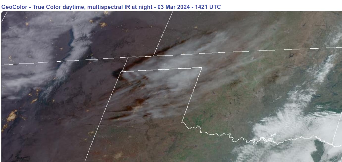
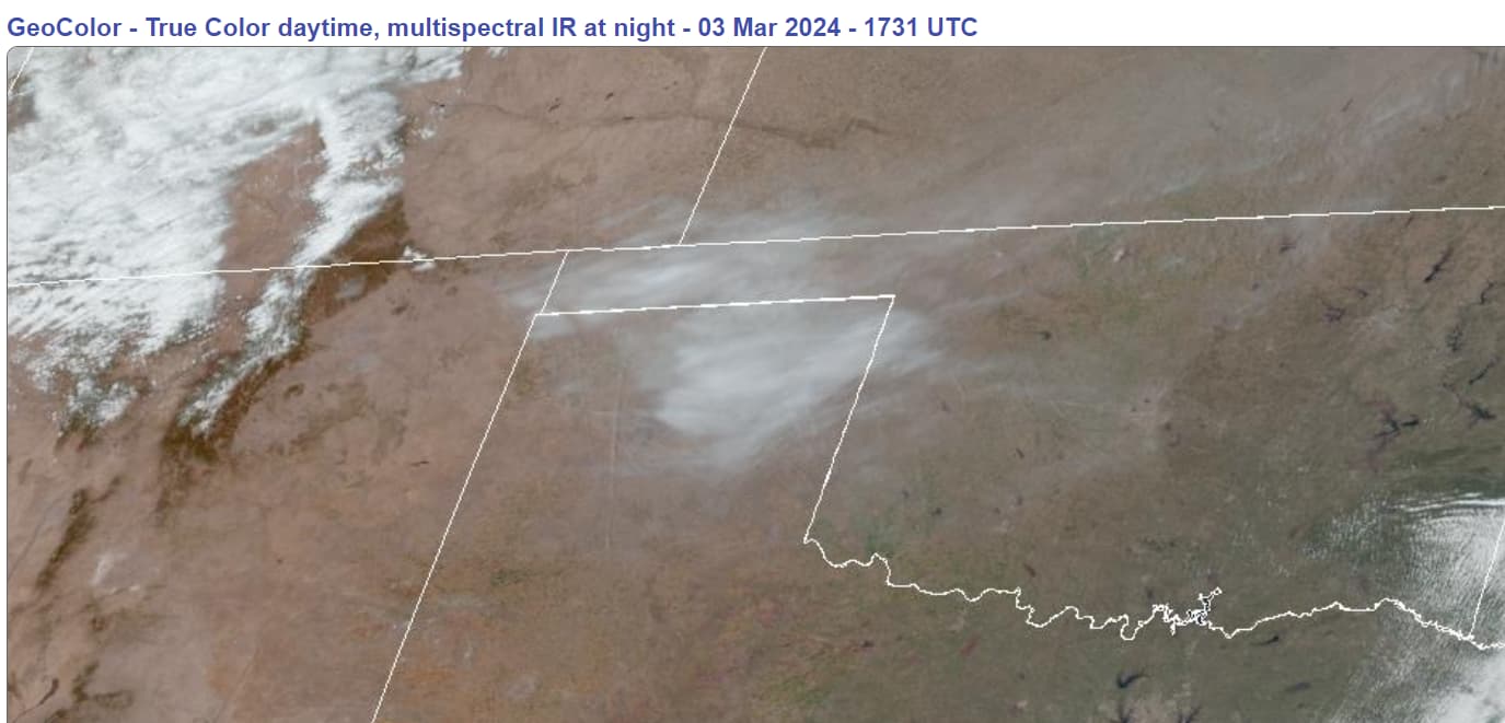
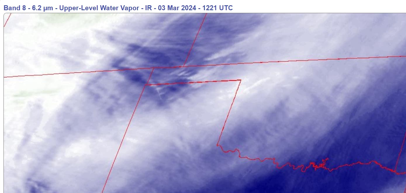
My, my, what weird clouds appeared over NW Texas this morning, replete with chemtrails. Wind is blowing hard yet the cloud mass remains STATIONARY. I expect trouble.
I recommend copying and pasting the URLs below. Let’s all watch.
I’m sorry if someone already posted this. https://m.youtube.com/watch?v=dD0m6XFGjYs&pp=ygUMYnJ1c2gganVua2ll
This fire in Chili was 50 miles long, has the same cars, houses and trees burnt (except blue) the same as Lahina. And 3 weeks before the fire a conference was held about Smart cities.
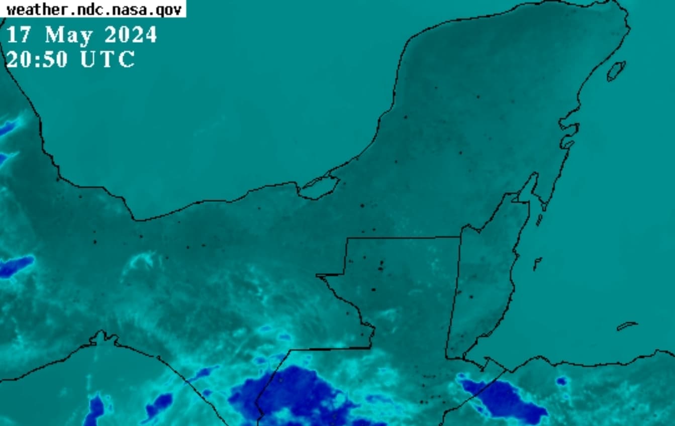
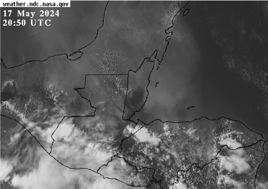
Southern Mexico (Yucatan peninsula states), Guatemala, Belize, Honduras and Nicaragua have had wildfires for weeks on end. Today (May 17, 2024) they seemed to have amp’d it up a bit. Lots more blinking black dots and odd clouds that “normal”.
. NASA Band 07 (Surface Infrared)4:20-hour animation link
I posted it on a BRI thread when it was first reported. Valparaiso is one of most used ports on Pacific So. America coast for centuries (just like Lahaina has been for centuries).