Stationary Temp Layer Northeast Atlantic

NASA GOES Band-07 Infrared Surface Temp

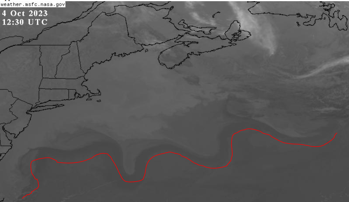
This caught my attention immediately this morning. Ocean surface temperature imagery off the New England coast shows a stationary pattern. Looking back, it has been there for several days. It has boundaries that do not move; the region above the red line is static and the shape is independent of visible cloud cover.

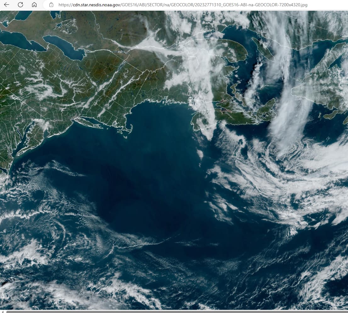
The air is exceptionally clear today, absent for the most part of visible clouds. The anomaly is an invisible layer (or perhaps barely visible in the GEO image below) of some sort and seems to be very low, altitude-wise.

**NOAA GOES Band GEO Composite Visual

I have seen stationary temp areas before, but only over land (e.g., cold air mass over Texas with freezing drizzle). The phenomenon is best seen when animated (4-hr zoom, 20-hr Conus, or 40-hr Full Disk).

This is the first time I’ve noticed such a large and defined “Static Temperature Zone” over the ocean.

Going completely off the end of the twig here, but the GOES animation looks like they are using that stationary line to squeeze all the rainy weather northeast and away from the CONUS, just in time for the FEMA test (of DEWs that work better without water).

1 Like

That is an interesting idea. I have stopped trying to figure out why they do things the way they do. Some events were obvious at the time, like funneling winds from the northeast across Maui all the while blaming a waning hurricane 600-miles off-shore (haha) and pushing Hurricane Hilary east away from LA. At minimum, all severe weather benefits climate change narratives; that is a given. But this is a first for me and is suggestive of the massive power this weather control machine has.

Meanwhile, we have days-old wildfire smoke from central Canada that was held aloft and directed to settle in Miami ahead of TS Philippe.

As for the DEWs, not sure which, if any they plan to deploy. If you haven’t seen my other posts, take a look, as I’ve cried loud and long about the visible manifestations of their use with surface targets. There is ample evidence of scalar radiation in cloud patterns that show directed energy across the atmosphere.

If, by scalar radiation patterns, you mean the weird ripples that appear in clouds and make them look like sand under water at the beach, these are becoming ridiculously common. We had large ones here yesterday at sunset. No other clouds in the sky, just giant pink ripples.