Uh Folks, Now Arkansas (February, 2024)

@sharick
It was my intent to let you know about the situation, in case you didn’t already know and to ask question for those interested to comment. That’s all.

My opinion is that I know it will affect Canada; I just don’t know exactly what the effects will be.

Thank you for bringing the storm to my attention. Sincerely.

They develop cyclonic weather in the Gulf of Alaska routinely. This one was a little different because they attached an atmospheric river, routed it down into California, and promoted it in weather headlines. Understand that they ran unadvertised atmospheric rivers into northern portions of both TS Hilary and Hurrican Lee as they approached landfall. Many days of generic “bomb cyclone” articles appeared just before this storm as well.

As Elana Freeland stated in her excellent 2018 book, there will someday be some 24 layers (my paraphrase) by which they control weather. Animated NOAA imagery over the Pacific Northwest showcases their hodgepodge appearance daily.

Wildfire smoke is frequently routed out to the Pacific, up to polar regions, down to the U.S., and/or over to the Atlantic. Circulation patterns appear more deliberate than happenstance, as shown in post 46 above.

I mention them because cloud cover and both active and recirculated fire smoke (and sometimes chemtrails) make it difficult to ascertain impact on fire. Let’s see what daylight today brings.

2 Likes

@undine
Coming your way. Please let us know if there is something significant like yellow dust that begins to show up.

September 25, 2023 11:40AM EST

September 26, 2023 11:40AM EST

September 27, 2023 11:40AM EST

1 Like

Will do. We had severe weather warnings for today and tomorrow but no exceptionally strong winds as yet. Blowing from the south so don’t expect to see anything untoward.

1 Like

Update: nothing unusual to report today. White / grey skies, as is now normal. I will continue to be watchful.

1 Like

Your observation of the intense smoke plumes NE of Ft St John and the associated high heat release was from the Donnie Creek fire which is B.C.'s single biggest-ever forest fire which as of today has burned 619,072 ha (1,529,760 acres). The total area burnt to date provincially is off the charts, currently around 2.3 million hectares (5,683,423 acres) .

Wind has been a contributing factor in the flare ups you observed. The BC Wildfire meteorologist noted that “sustained winds of 30km/h + gusts to 70 km/h will support a large spread day, particularly on the heels of hot, dry weather. Some of the fires took >30 km (18 mile) runs in just 24hrs.”

More generally over the last several years (including this year), when there has been a bad fire season in BC there has often been a trend of a prolonged cool spring resulting in lush vegetation, followed by an abrupt switch to hot dry weather followed by unusually high levels of lightning (episodes of up to 10,000 to 30,000 strikes over a few days). Lightning is frequently the leading cause of wildfires in BC.

If someone controlling the weather wanted to inflict maximum damage this is the perfect formulae.

The interesting thing is that mainstream scientists are now expressing shock over the rapid increase in wildfires much faster than the climate models predict. .

Just published in Nature is an article titled Abrupt, climate-induced increase in wildfires in British Columbia since the mid-2000s. Abrupt, climate-induced increase in wildfires in British Columbia since the mid-2000s | Communications Earth & Environment

Quoting from the article as follows …“What is surprising, however, is the early onset of the increase in wildfire activity around the year 2000—decades earlier than anticipated—and the sheer magnitude of fire-season severity (e.g., three of the past 7 years experienced >1 M ha or >1% of the land area burned; compared to only three wildfire seasons from 1919 to 2016 surpassing 0.5 M ha).”

Adding to this here is a recent “X” post by Yan Boulanger a Climate Scientist with Canadian Forest Service

“The 2023 Canada wildfire season continue to “surprise” us with one of the most insane daily area burned of the year, at the END OF SEPTEMBER! On September 23, the equivalent of 1/3 of an entire average fire season burned in northern AB, BC and southern NWT. Let that sink in…”
image

Addressing the situation globally

Prof. Stefan Rahmstorf, Head of Earth System Analysis , Potsdam Institute for Climate Impact Research & professor of Physics of the Oceans posted on “X” “We don’t understand the surprise upward leap that is happening now. And that worries me.”

I am wondering if we are starting to see a disaster unfolding from the cumulative effects of geoengineering - out of control warming. I am interested in any thoughts you may have on this.

2 Likes

Thank you kindly for soliciting my input. You raise a good and reasonable question.

By an unfolding disaster “from the cumulative effects of geoengineering” I assume you mean “out of control warming” as it may apply to 2023 Canadian fires and/or conclusions derived in the related articles cited above (post #57). If not, I missed your point and have droned on for naught.

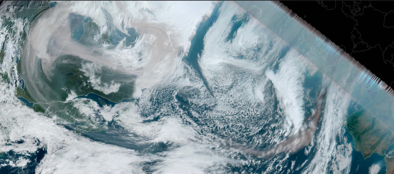
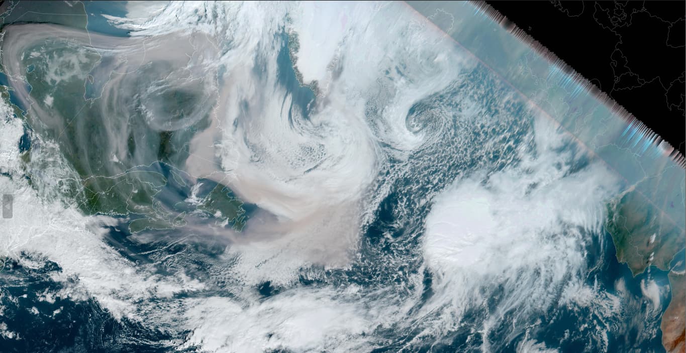
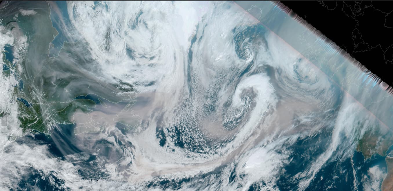
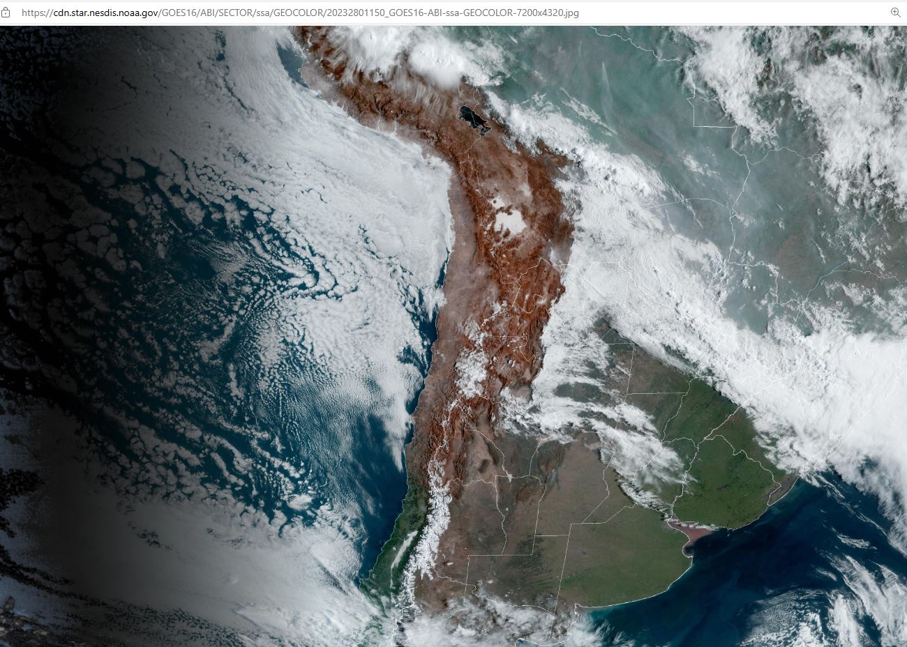
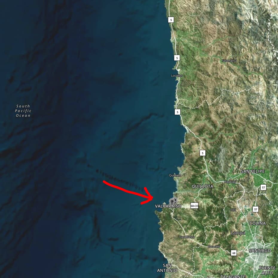
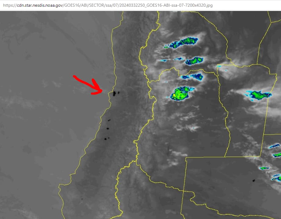
1 Drought Control Global warming is certainly not out of control; to the contrary, I believe it is in full control, or should I say, under the full control, …of “THEY” whoever they are. One of the purposes of chemtrails, and the directed energy used to excite them, is solar radiation management. A visible manifestation of that is what I call “pond scum” clouds. Clouds like those seen below west of Chile and Peru are great examples (Oct 6, 2023).


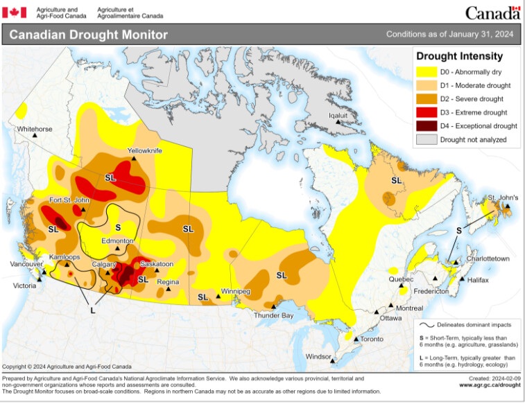
Pond Scum is pillowy, blotchy, and quite unnatural in appearance. Understand that the daily blanketing of large portions of the North and South American coasts blocked normal precipitative weather from passing inland for months on end in '21 and '22. THEY created the severe droughts seen in the U.S., Canada, Chile, and Argentina, to name just a few. Yes indeed, THEY, in full control, determine which lands get rain and which do not; consequently, conditions that partially facilitated a more rapid wildfire spread, were planned well in advance.

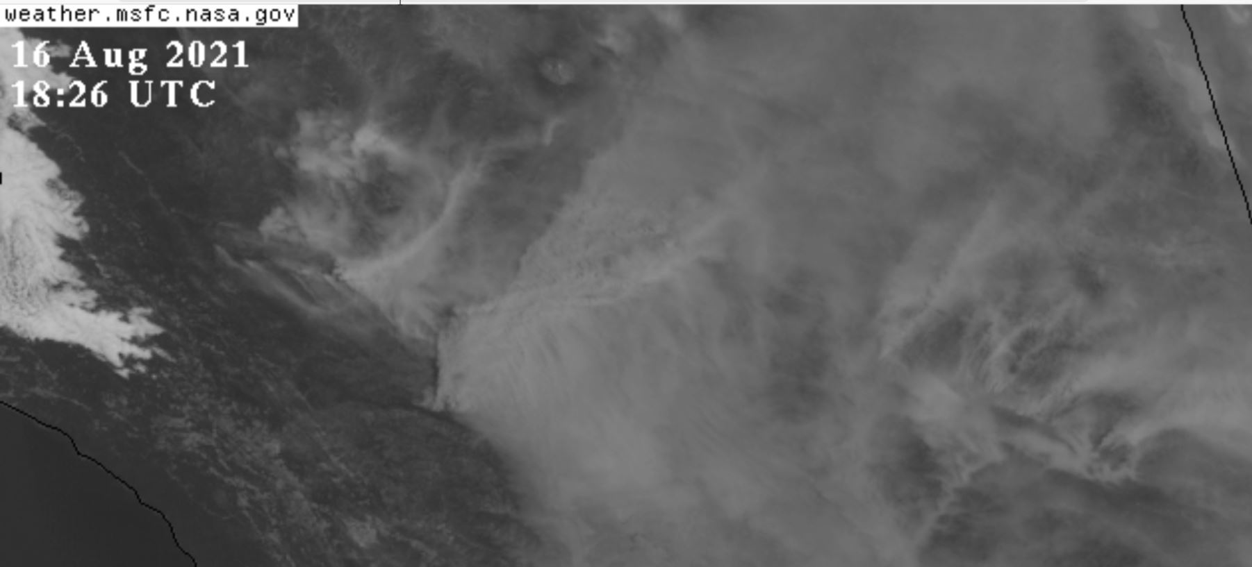
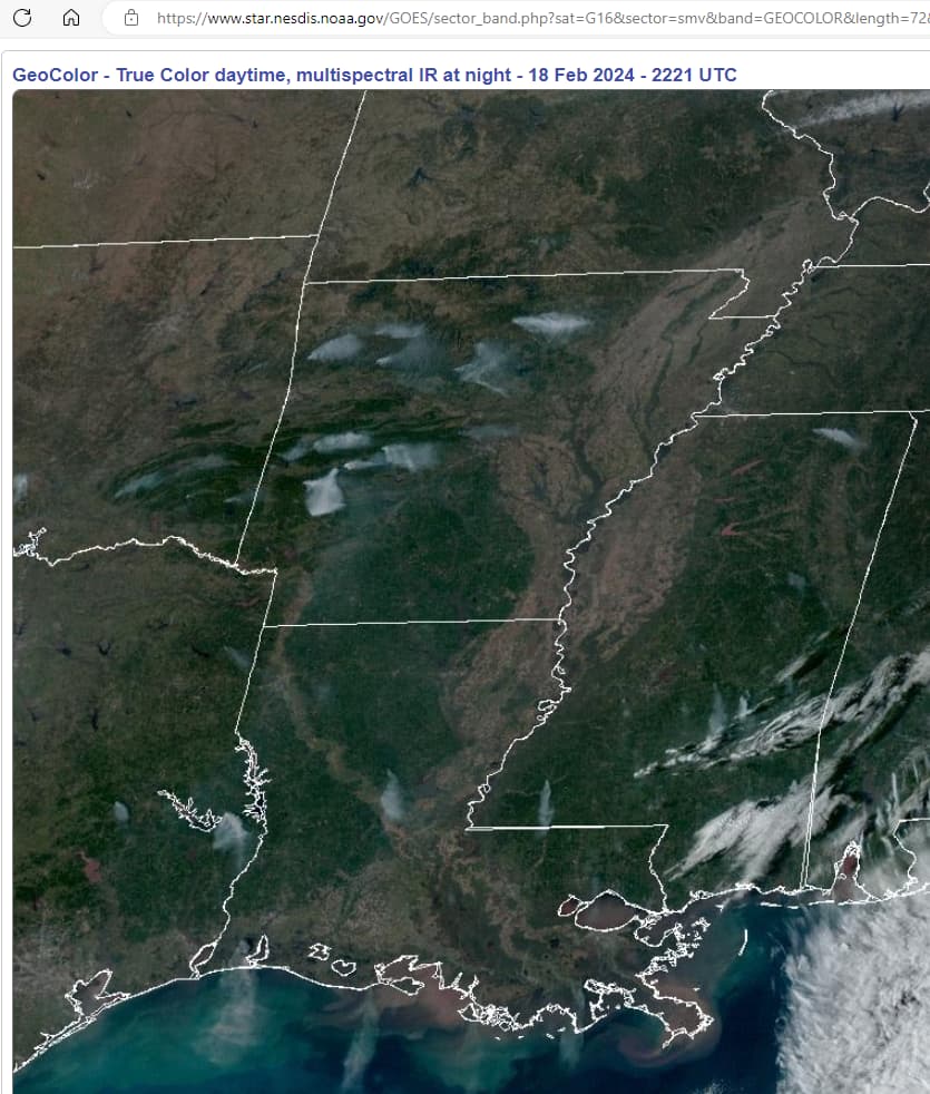
2 Wind Control Just like THEY did for the Lahaina Massacre, winds were delivered to where needed. It seems a trivial matter for them not only to turn them on and off like light switches, but to point them in intended directions. Countless 2021 fires in northern California and Oregon erupted, or should I say, re-erupted, daily, most often around lunchtime. The image below shows dozens of NorCal fires (Mt. Shasta at top) that went ballistic because “winds picked up.” Yeah, right.


Yes, the wind was a partial factor in the spread of those fires, but, but, but… the explosive increases in heat, spawning of new, non-downwind adjacent fires, and synchronization with many other distant wildfires (dozens) behaving the same way, were very unnatural. Yes, THEY are in full control of wind patterns and planned to walk distant Hurricane Dora opposite the high-pressure system formed northeast of the Hawaiin Islands.

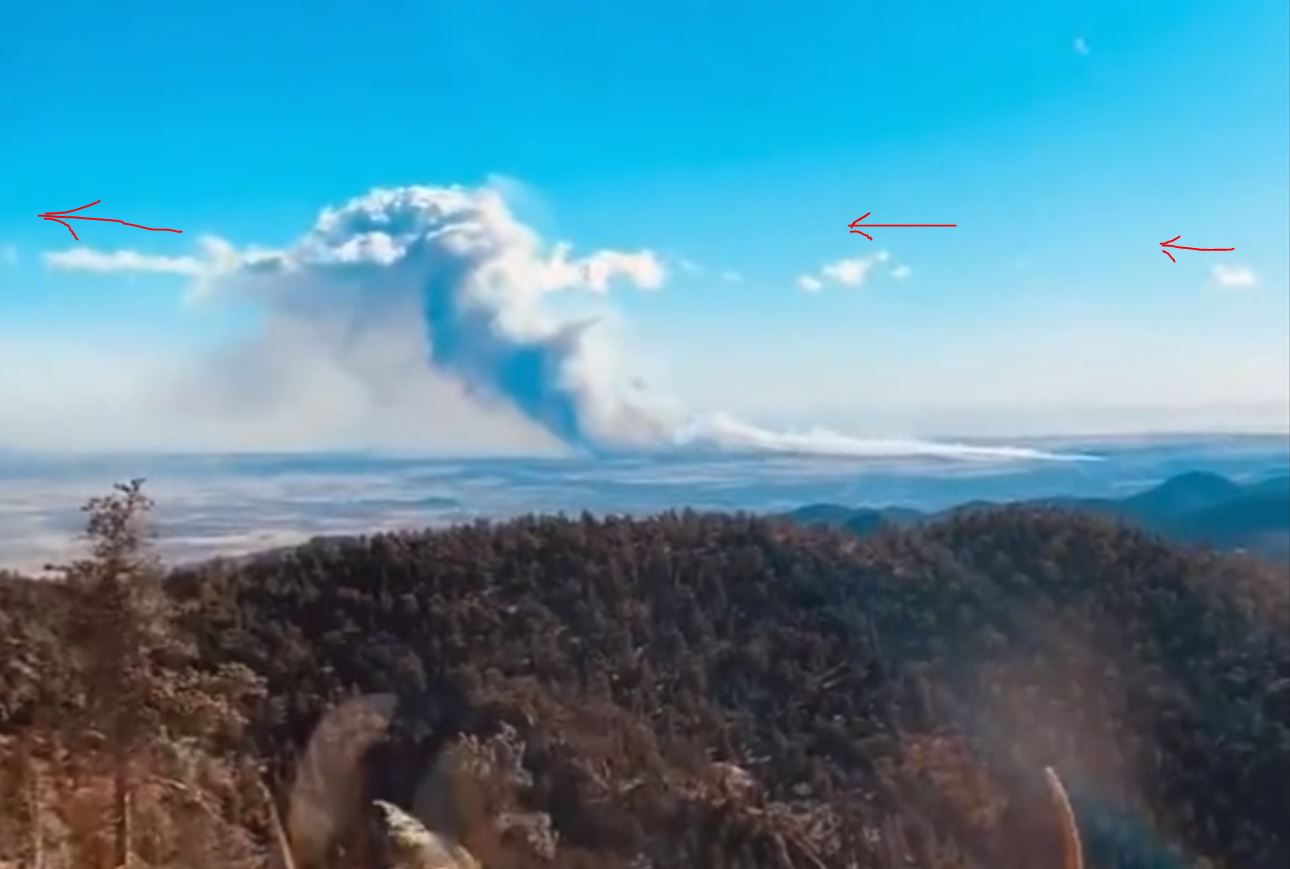
3 Chemical Control In many of these wildfires, special clouds and air masses visit the region. Puffy whites turn on and off and have an odd rippling behavior, quite suggestive of scalar radiation of some sort. Fires that go pyro (“make their own clouds”) are always accompanied by these puffy whites, which likely contain conductive aerosols that facilitate pyro cumulonimbus formation as well as higher fire temps.

Too bad we can’t post videos here. Below is a time lapse of the 2021 Marshall Fire in Colorado. The puffy whites appeared across the fire in a line and only near the fire, and some were definitely upwind of the fire. This was a clear blue sky otherwise. I saw multiple videos of this and believe those clouds also facilitated the DEW hits.

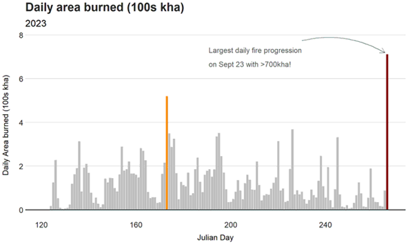
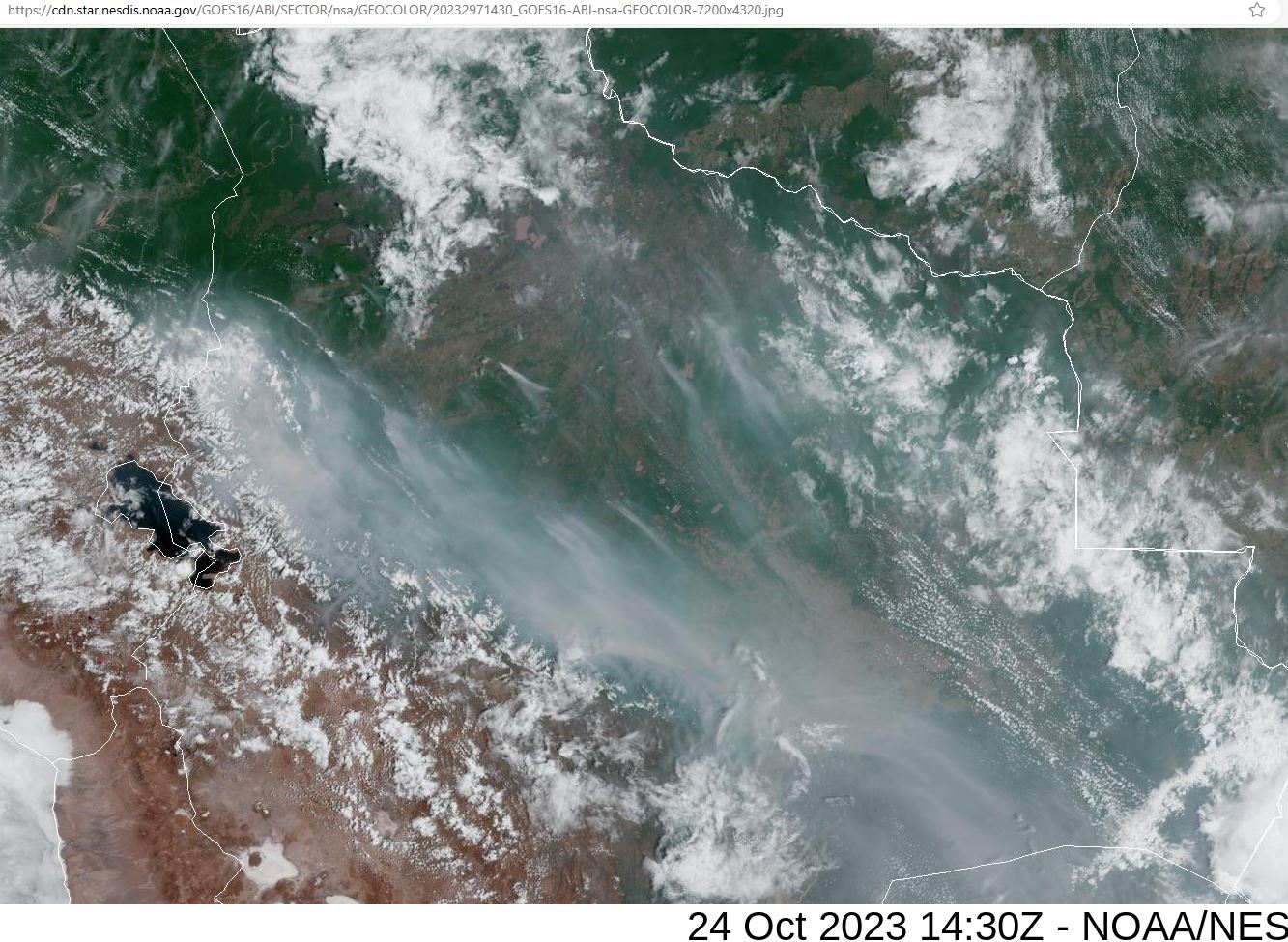
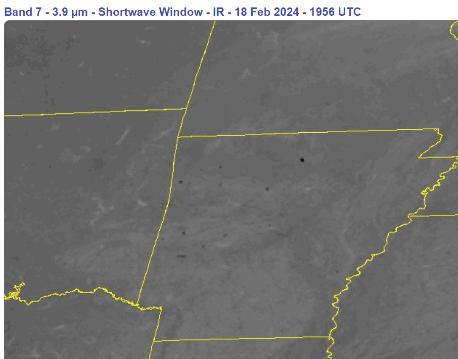
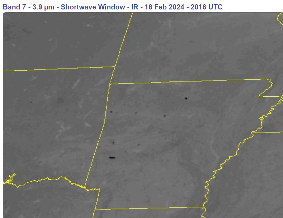
4 DEWs I have discussed directed energy weapons and Black Dots (see through NOAA satellite imagery) elsewhere on Giza and in this post ad nauseam. Briefly stated, energy was added to the Canadian Fires to make them burn more fiercely. I contend that drought conditions, continuity of fuel (unmanaged forest brush) and high winds were insufficient to create the heat signatures seen each time those dozens of fires erupted simultaneously. DEWs are what make these fires so cataclysmic. Take aways DEWs and we would go back to normal wildfires. Episodes of DEW hits happened in Nova Scotia, Quebec… every one of the Canadian provinces and territories experienced them.

5 Narrative Control Prepping a region with drought, bringing in high winds, and sometimes lacing the area with aerosols fully facilitates the climate change agenda and increasingly shrill narratives, over and over and OVER AGAIN. The whole thing follows the typical globalist method:

Create the Problem = Fabricate increasingly severe climate disasters worldwide
Manage the Reaction = Broadcast climate change narratives everywhere; ridicule opposition
Impose the Solution = Reduce population, eliminate property rights, consolidate political power, create death and misery in the process

Like typical leftists, they proffer new terms that are repeated so often they must be true. Bomb cyclones, hurricanes that disconnect, rope clouds, etc.

5 Conclusion There are real cumulative effects of geoeingeering. How can there not be when millions of tons of chemical aerosols are sprayed annually, when some regions are denied rain for years while others have an excess? I used to think polar ice melting was hyperbole–not anymore. Perhaps honeybees are dying because of aluminum in the atmosphere and likely a host of other creatures and systems on the earth are impacted.

The authors of those Canadian Fire articles have one thing in common with “traditional climate change deniers”–their reports all exclude effects of geoengineering activity. I can’t say whether the omissions were intentional, but like those Nobel Prize winning climatologists (climate change deniers) who say that we are just seeing normal variations in weather, I ignore them completely because they either can’t see the elephant in the room (geoengineering) or more ominously, they are controlled opposition.

6 Take Away (for those who didn’t read the post)
What we DO have here, are the cumulative effects of out-of-control geoengineers.

5 Likes

Thanks for the detailed reply , everything you stated makes sense to me. In the highly unlikely event “they” were to stop geoengineering do you think the cumulative damage is reversible ?

1 Like

I honestly don’t know. The chemicals will eventually fall or precipitate out of the atmosphere become part of land and sea ecosystems everywhere. Some will breakdown while others not. Nanoparticles? Not sure what happens to them.

We also don’t know if there has been permanent damage to things like the magnetosphere, ionosphere, ozone layer, etc. I think it likely something has been altered.

I do believe the earth is resilient, as we have had success stories like recovery from industrial pollution of the Cuyahoga River in Ohio. If chemtrail spraying and all the atmospheric radiations were to stop, I think some sort of natural cycles of jet streams, air mass movements, evaporation, cloud formation, precipitation, etc., would return.

4 Likes

Bolivia

Can add Northern Australia to the list . Information below was posted yesterday by Dr Robbi Bishop-Taylor an earth observation scientist working for Geoscience Australia

3 Likes

Thank you for the suggestion, @sunnyboy. Wow, it looks really bad from what that link showed.

Understand that I do not scrutinize weather and fires much beyond the western hemisphere; mostly because of time constraints but also from a limited understanding of non-NOAA geostationary satellite websites. There is so much happening in North America that I would like to post, but seldom find time to sit down so post something semi-intelligible and informative.

Some of these intensified fires may have started from natural or accidental causes; else they were intentionally set, either by arson or DEWs. I contend that all intensified fires (those with unnaturally-appearing satellite infrared signatures) are perpetuated by DEWs. They are rampant, daily criminal acts in plain sight and the world is clueless.

2 Likes

Chile’s turn, it seems. Some images of rubble reveal signs of excessive heat such as that seen in the Lahaina fire and many in California. No surprise, especially upon seeing the infrared surface temp indications.

3 Likes

The article linked below provides some additional information on the wildfire impacts.in Chile that might be of interest. In SW BC the mountain snow cover was recently reduced to 28% of normal by a prolonged “Pineapple express” potentially setting the stage for a bad fire season especially if the drought situation does not improve.

. The peach and nectarine crop in the central interior is a write off due to severe bud kill caused by an early deep freeze followed by thaw cycle. T

3 Likes

Feb 18, 2024: Arkansas, Louisiana, Mississippi, Oklahoma, Texas
Not a peep on the news, so far as I can tell. These areas are too green; they must be changed to brown.

In 40 minutes, the forest in east Arkansas (Polk Co) goes from nothing to maximum infrared surface temp (below). Three synchronized linear dots, how natural.


1 Like

@sunnyboy @sharick
Thank you both very much for tracking all this. VERY important! If you don’t mind, I would like to post a few of the illustrations on my ‘BRI burn’ thread.

1 Like

@beaver Feel free to post as you see fit.

1 Like

Why might someone be setting all these fires? Hoisting all those chemtrail particulates up to 40K feet has to be very expensive/inefficient. Perhaps it’s much easier for them to set fires and let the particles (smoke) lift themselves up to modify albedo/the sunscreen.

1 Like

@XSEXCESS I don’t believe cost is an issue for any endeavor of the elites. After all, it is not their money being expended.

As to why, for certain, we will likely never know. The particulates can be useful, but I believe the fires must be of California-2021 and Canadian 2023 size to have sufficient effect as sunscreen. Any observation of the eastern Pacific along South America would reveal that they have no problem creating sunscreen on a daily basis. It is the same pond scum as they parked alongside North America from 2020 through 2023.

I also think the particulates greatly enhance rapid nucleation of water molecules.

These Arkansas fires, like most I’ve seen in the southern U.S. (for several years) are the drive-by-DEW fire types, which die down quickly at sunset. They most frequently occur in forested parks, sometimes in conjunction with controlled burns. Few people, both here on Giza, and in my circle of contacts, are interested in these fires. It is not worth the time to investigate and catalogue anything about them.

I will say again, it isn’t the STARTING of these fires that is of primary importance; rather, it is the INSTENSIFICATION & PERPETUATION of them. Take away the external energy source, the weapon, whatever “it” is, and these fires would be fractional in size, regardless of the wind (that they also create). Artificial clouds, chemtrails, aircraft, spacecraft, satellites are viable candidates as the weapon platform(s). Is the weapon platform beaming invisible directed energy to heat the area? Or is the platform providing some sort of heated discharge path out of or into the earth? To achieve the blinking black dot patterns of intense surface heat shown on satellite infrared channels, requires quite a bit of added heat.

It is only speculation, but I contend that some sort of combined laser-microwave technology exists that is aloft in the atmosphere. Nanoparticle clouds may serve as lenses to direct and focus the energy and/or cover for advanced aircraft. Since most black-dot fires subside at sunset, I further speculate that solar radiation forms part of the energy source, perhaps as a power supply. I estimate that some 80-90% of all black dot fires begin at noon and end at sunset.

Robert Brame makes a good case for microwave technologies as he has forensically examined some 38 fire sites in California.

I also believe drought and soil damage is occurring from the fires, likely intentional, too. I have seen fires that left me wondering whether burning combustibles on the surface are an unavoidable outcome of heating the soil, bedrock, aquifers, etc., below. Heck, I don’t know how deep the energy propagates. And then there is the seismic fault aspect. What a great toy, eh?

2 Likes

Feb 19, 2024: Arkansas, Louisiana, Mississippi, Alabama, Florida, No & So Carolina

I spy with my little eye 14 easily seen plumes. How 'bout you?